
Jávea Viewpoints from Benidorm: The Best Scenic Route Along Xàbia’s Coast
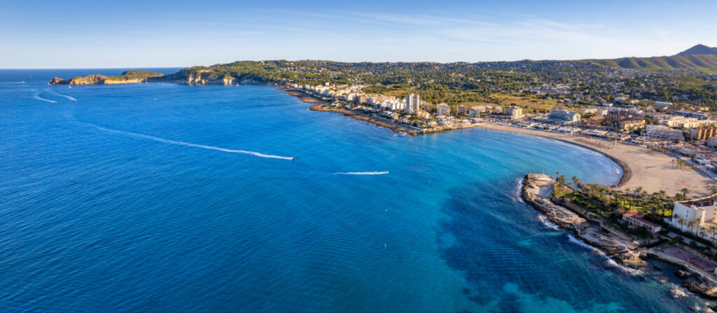
Jávea is one of those places where the coastline does most of the talking.
You do not need a monument at every stop, a long list of attractions or a complicated itinerary. What makes this part of the Costa Blanca memorable is the way the land repeatedly breaks toward the Mediterranean: cliffs, capes, pine-covered slopes, islands, hidden coves and long stretches of open sea.
The official Xàbia viewpoint route includes 15 marked viewpoints spread across roughly 25 kilometres of coastline, running from the northern end near Cap de Sant Antoni down toward Granadella. The route takes in very different landscapes, from broad bay views and old windmills to steep cliffs, offshore islands and some of the most recognisable coastal scenery in Alicante province.
On paper, that sounds like a simple sightseeing route.
In reality, it works much better when you stop thinking about “collecting” viewpoints.
Fifteen stops can quickly become repetitive if you approach them as a checklist. Park, photograph, return to the car, drive ten minutes, repeat.
That is not the best way to experience Xàbia.
The more rewarding approach is to use the viewpoints as a thread connecting different sections of the coast. Some are worth ten minutes. Others deserve a proper stop, a short walk or time simply sitting and looking out over the sea. A few are impressive enough to justify building the route around them.
That distinction is important for anyone coming from Benidorm.
You are not travelling all the way to Jávea because there are fifteen signs labelled mirador.
You are going because the coastline around Xàbia is unusually varied, and the viewpoints provide one of the easiest ways to understand it.
The official tourism guide itself highlights Cap de Sant Antoni, Els Molins, Portitxol, Cap Negre and Cap de la Nau among the most notable viewpoints.
Those will form the backbone of this guide.
The rest will help complete the route rather than compete equally for your attention.
What Are the Jávea Viewpoints?
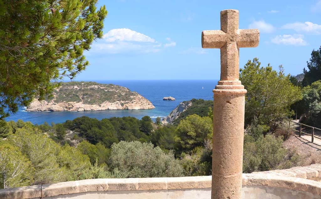
The Miradores de Xàbia are a network of designated scenic stops distributed along the municipality’s coastline.
They are not all identical.
Some are large panoramic areas that look across the sea from high cliffs.
Others sit beside old structures, beaches or residential roads.
A few provide access to short walks or natural areas.
What connects them is not a single trail, but the coastline itself.
Xàbia’s geography makes this possible because the shore changes character repeatedly over a relatively short distance. The municipality describes a coastline of about 25 kilometres, marked by cliffs, islands, caves, coves and beaches ranging from open urban stretches to much smaller rocky inlets.
That diversity is what makes the viewpoint route more interesting than a series of elevated photo stops.
You are effectively moving through several different coastal landscapes in one day.
From Montgó to the Mediterranean
The northern part of Xàbia is dominated by the presence of the Montgó Natural Park and Cap de Sant Antoni.
This is where the mountain landscape reaches the sea.
The result is broad, elevated views over the bay, the port and the coastline to the south.
Cap de Sant Antoni also forms part of an ecologically important marine environment. The surrounding marine reserve protects a rich underwater landscape of Posidonia meadows, rocky habitats and other Mediterranean marine communities.
Even if you never enter the water, that protected setting helps explain why the northern coastline feels different from a conventional urban viewpoint.
This is not simply a hill above Jávea.
It is the edge of a mountain and marine landscape meeting in the same place.
The Bay Changes Everything
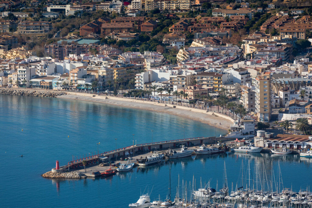
Moving south, the coastline becomes more urban around the main bay.
You pass the port, the Arenal area and sections where beaches, promenades and residential development become much more visible.
This part of the route is less dramatic than the major cliff viewpoints, but it helps create contrast.
Without it, the southern viewpoints would feel disconnected.
The official sequence includes places such as Punta de l’Arenal, Séquia de la Nòria, Cala Blanca and Caletes before reaching the more rugged Portitxol area.
Some visitors will enjoy stopping at several of these.
Others will prefer to drive through and concentrate their time farther south.
Both approaches are valid.
The important thing is that the route gradually changes from open bay scenery into a more broken, dramatic coastline.
Portitxol Is Where the Route Becomes More Dramatic
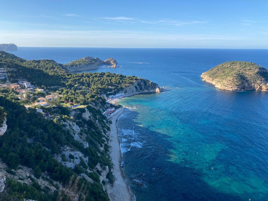
Around Creu del Portitxol, the character of the day changes.
The coastline becomes steeper.
Pine-covered slopes descend toward the sea.
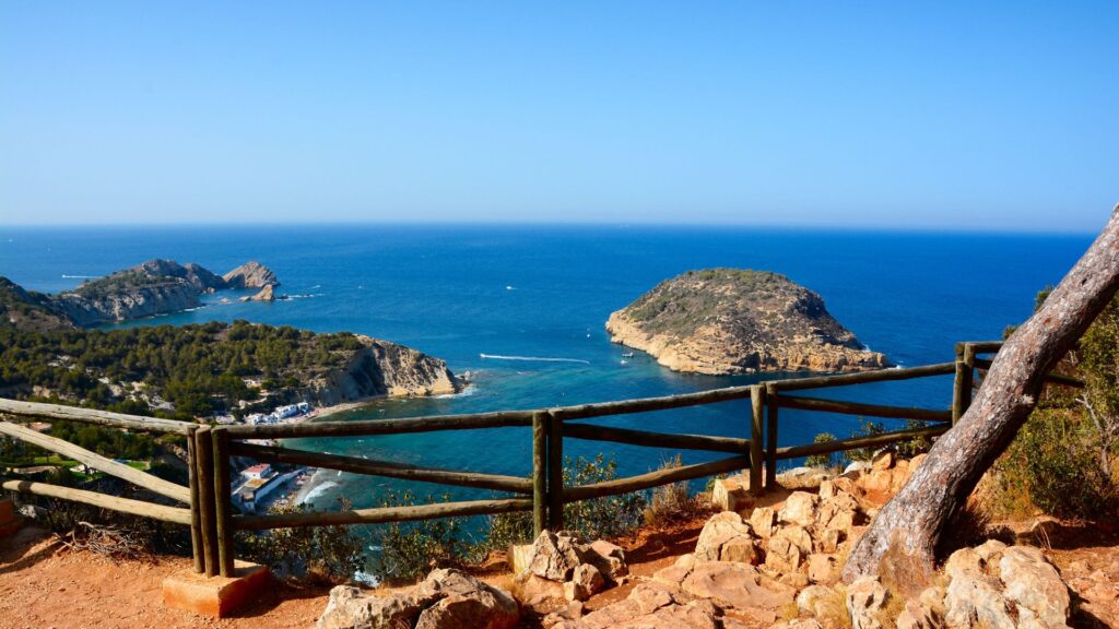
The island of Portitxol sits just offshore.
Small coves begin appearing between rocky headlands.
This is where many visitors start to understand why Xàbia’s viewpoints have developed such a strong reputation.
From here south, several stops offer genuinely different perspectives rather than minor variations of the same bay.
La Falzia looks down over the Portitxol area from above.
Cap Negre pushes farther out toward the sea.
Cap de la Nau occupies one of the most prominent headlands on this section of the Costa Blanca.
Ambolo introduces another steep cove landscape.
Granadella finishes the route in a greener, more enclosed environment.
The progression becomes part of the experience.
You Are Not Driving a Continuous Coastal Road
This is worth understanding before you arrive.
The viewpoint route does not mean you simply follow one road beside the sea for 25 kilometres.
Xàbia’s coastline is too irregular for that.
You move through:
- residential roads;
- inland connectors;
- short coastal stretches;
- parking areas;
- paths toward certain viewpoints.
Sometimes you leave the sea completely before returning to it at the next cape.
That can initially feel less scenic than expected.
But it also creates anticipation.
You turn through houses and pine trees, park somewhere that does not look especially dramatic, walk a short distance and suddenly the Mediterranean opens below you.
Several of the best viewpoints work precisely because the view is not visible throughout the approach.
Why Do This Route from Benidorm?
Benidorm already has excellent coastal viewpoints.
Serra Gelada gives you cliffs, La Cruz provides a panoramic city view and the surrounding coastline contains no shortage of places to look over the Mediterranean.
So why drive to Jávea simply to see more sea?
Because the landscape is different.
Benidorm’s coast is strongly defined by its urban setting and high-rise skyline.
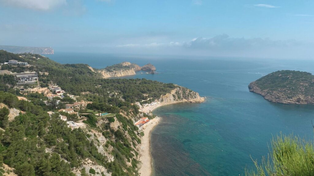
Jávea’s southern coastline is much more fragmented.
Capes project into the sea.
Islands sit offshore.
Cliffs repeatedly break the horizon.
Pine forests reach toward rocky coves.
Residential development exists, sometimes extensively, but the underlying geography still dominates the experience.
That difference is what makes the journey worthwhile.
A Scenic Day Rather Than a Single Attraction
Many day trips have one obvious objective.
At Peñón de Ifach, you climb the rock.
At Canelobre, you enter the cave.
At Guadalest, you explore the fortified village.
Jávea’s viewpoint route works differently.
There is no single moment where you can say:
“That was the attraction. Now we are finished.”
The value accumulates throughout the day.
One viewpoint may have the better island view.
Another has the more dramatic cliffs.
Another feels peaceful because there are fewer visitors.
Another works because you stop for coffee nearby or walk for twenty minutes before reaching it.
That makes the route particularly suitable for people who enjoy driving slowly, stopping often and letting the day develop naturally.
It Is One of the Best Ways to Understand Xàbia
Jávea is not just one town centre and one beach.
Its identity is spread across several distinct areas: the historic centre, the port, Arenal, Montgó, the capes and the southern coves.
The viewpoint route physically connects many of those landscapes.
By the end of the day, you understand Xàbia’s geography much better than someone who simply spent three hours at Arenal Beach.
This is especially relevant for long-stay visitors considering returning to Jávea, staying there temporarily or simply exploring more of the northern Costa Blanca.
The route gives you context.
The Views Change Enough to Avoid Repetition
This is probably the most important reason the route works.
If all 15 viewpoints offered the same perspective, the experience would become tedious quickly.
They do not.
Cap de Sant Antoni is broad and elevated.
Els Molins adds cultural interest through the old windmills and panoramic views over the bay. The official Les Planes route describes the windmills as a distinctive group from which you can see a wide panorama across Xàbia Bay and the surrounding mountains.
Portitxol is defined by the island and broken coastline.
Cap Negre feels more exposed and rugged.
Cap de la Nau has the character of a major headland.
Granadella feels more enclosed and green.
Those differences provide enough variation to sustain a full scenic route.
It Is Flexible
You do not need to visit all 15 viewpoints.
In fact, for a first trip from Benidorm, I would actively recommend not trying to do that.
A much better day might include six or seven strong stops, lunch, perhaps a beach or short walk, and enough time to enjoy each place properly.
Someone with only half a day could reduce that to four essentials.
A photographer might spend an hour at one viewpoint and skip three others.
A visitor travelling in summer may prioritise areas where parking and access are simpler.
That flexibility makes the route easy to adapt.
The Journey from Benidorm Is Part of the Experience
Jávea sits north of Benidorm, beyond Calpe and toward the northern end of Alicante province.
The journey itself already begins moving you into a different coastal environment.
The mountains become more prominent, the urban coastline becomes less continuous and the landscape increasingly reflects the northern Marina Alta.
By the time you reach Cap de Sant Antoni, you are looking south along a coastline that feels connected to Benidorm geographically but visually distinct.
That is exactly the kind of contrast this series is meant to find.
Who Is This Route For?
The viewpoint route works particularly well for people who enjoy landscapes more than attractions.
It suits photographers, couples, slow travellers and anyone who likes combining short walks with scenic driving.
It is also a good option for visitors who want an active day without committing to a demanding hike.
You will walk.
You will climb some short slopes.
You may spend time on trails or cliff paths.
But the day can remain physically easy if you want it to.
Who Might Find It Boring?
Anyone who needs a major attraction at every stop may struggle with the concept.
There are no castles at every viewpoint.
No museum ticket.
No organised activity.
Sometimes the experience is simply:
park the car, walk toward the edge, look at the Mediterranean for fifteen minutes and move on.
For the right person, that is exactly the appeal.
For someone who wants constant entertainment, it may feel repetitive.
That is why this guide will not insist that every official viewpoint is essential.
The goal is not to complete the route.
The goal is to build the best coastal day possible from Benidorm.
And that means knowing which places deserve your time and which ones can comfortably be left for another visit.

Northern Jávea: Cap de Sant Antoni and Els Molins
If you are driving from Benidorm, the northern end of Xàbia is the logical place to begin.
Starting at Cap de Sant Antoni gives the day a proper sense of arrival. You are not yet in the most dramatic section of the southern cliffs, but you immediately understand how Xàbia is positioned between mountain and sea.
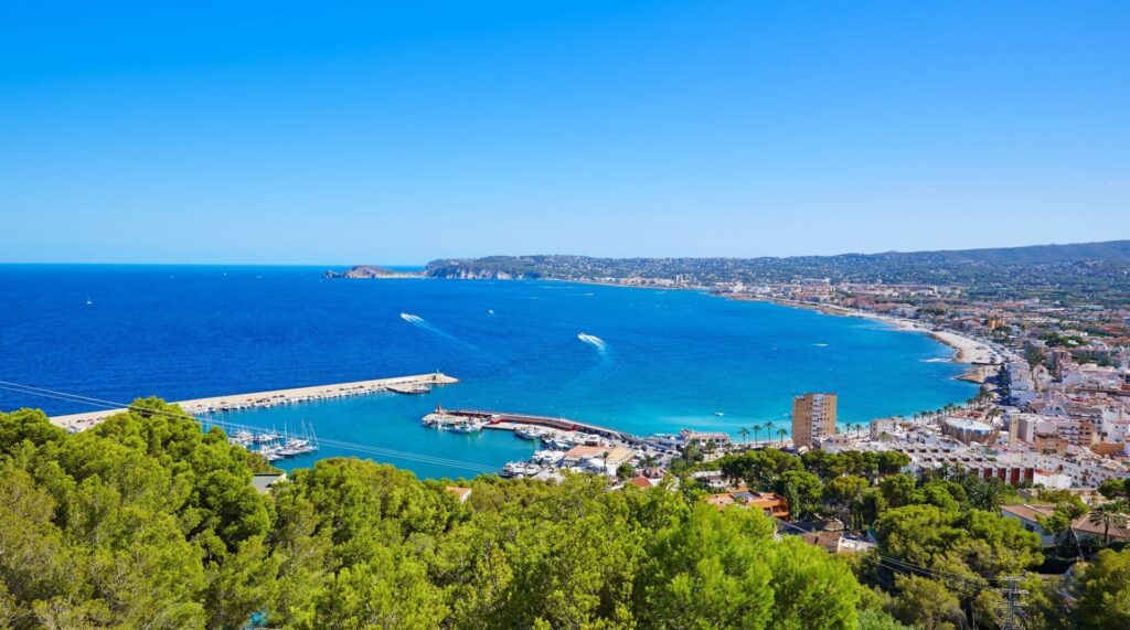
From this elevated headland, the bay opens below you, with the port, town and coastline stretching south. Behind you, the Montgó landscape rises inland. Ahead, the Mediterranean extends toward the rest of the viewpoint route.
It is one of the best places to stop before you begin moving through the more fragmented coastline farther south.
The official Xàbia tourism material places Cap de Sant Antoni among the most important viewpoints on the route, while the surrounding area forms part of the Montgó Natural Park and the protected Cap de Sant Antoni marine environment.
Cap de Sant Antoni: The Best Place to Understand the Bay
Cap de Sant Antoni is not necessarily the most dramatic viewpoint of the day.
That may sound like a strange way to introduce one of the route’s highlights, but it is exactly why the stop works so well at the beginning.
The view is broad rather than intimate.
You are looking at the structure of Xàbia as a whole.
The port sits below.
The bay curves away toward the Arenal.
Residential areas spread across the slopes.
Mountains frame the inland horizon.
The effect is panoramic rather than theatrical.
This makes Cap de Sant Antoni particularly useful for orientation.
Later in the day, when you are standing above Portitxol or Cap Negre, you will be looking at smaller sections of coastline in much greater detail.
Here, you get the bigger picture first.
The Headland Feels More Natural Than Urban
Although Xàbia itself is clearly visible, the immediate environment around the viewpoint feels much more connected to the natural park than to the town.
The terrain is rocky and exposed, with Mediterranean vegetation and open views in several directions.
That matters because it creates a strong contrast with the drive from Benidorm.
You have only travelled a relatively short distance north, but the atmosphere is already different.
The skyline has disappeared.
The sea feels larger.
The land feels less controlled.
This is also where the protected character of the coastline becomes easier to understand. The official coastal guide describes the marine reserve around Cap de Sant Antoni as an area of high ecological value, with steep coastal walls, small coves and a rich underwater environment that includes Posidonia meadows and other Mediterranean habitats.
You may not see any of that underwater biodiversity from the viewpoint itself, but the knowledge changes how you interpret the landscape.
You are not simply looking at another attractive piece of coastline.
You are looking over a protected marine environment.
Should You Spend a Long Time Here?
Probably not on a first viewpoint day.
Twenty to thirty minutes is enough for most visitors.
That gives you time to walk around, look across the bay, take photographs and enjoy the sense of scale.
If you are especially interested in walking, however, this area can easily become a destination in its own right.
The nearby Les Planes landscape includes walking routes through the Montgó Natural Park, including a low-difficulty route of around 4.5 kilometres linking the recreational area with the windmills. Official route information estimates roughly two hours for that circuit.
That is useful to know because it gives you options.
For the full scenic viewpoint route, keep moving.
For a slower day focused only on northern Xàbia, you could spend much longer here.
Best Time for Cap de Sant Antoni
Morning works very well.
The first part of the day generally gives you clearer visibility and a calmer start before the route becomes busier.
The viewpoint is also exposed, so strong wind can change the experience considerably.
On a still day, it feels peaceful.
On a windy day, it can feel much more dramatic.
Neither is necessarily bad, but the atmosphere changes quickly.
For photography, morning light often works well because the bay is easier to read as a landscape rather than as a flat area of glare.
Els Molins: A Viewpoint With More Than a View
Els Molins is one of the most interesting stops on the route because it adds something the other viewpoints do not have.
History.
The windmills on La Plana turn what could have been another good coastal panorama into a place with a much stronger identity.
Official Xàbia route information describes the Molins de la Plana as a distinctive group of historic windmill towers and highlights the wide views from this point over Xàbia Bay and the surrounding mountains.
That combination makes Els Molins particularly rewarding after Cap de Sant Antoni.
The two stops are geographically close, but they do not feel repetitive.
The Windmills Change the Character of the Stop
At Cap de Sant Antoni, the landscape dominates everything.
At Els Molins, the old structures become part of the composition.
The cylindrical stone towers sit on the elevated plain above Xàbia and immediately give the place a stronger cultural feel.
You are still looking across the same general bay, but the windmills provide a visual anchor.
They also remind you that this plateau was not always just a scenic place.
Wind was once an economic resource.
The position that now gives visitors wide panoramic views also made sense for milling because the exposed terrain could capture the prevailing winds.
That link between landscape and traditional use gives Els Molins more depth than a standard roadside viewpoint.
Is Els Molins Worth Stopping After Cap de Sant Antoni?
Yes.
Even though the two viewpoints look across similar territory, they tell different stories.
Cap de Sant Antoni is about geography.
Els Molins is about landscape shaped by people.
The first helps you understand the coast.
The second adds history to that same coastline.
For most first-time visitors, I would include both rather than choosing between them.
How Long Should You Stay?
Around thirty minutes is enough for a straightforward visit.
Longer if you enjoy photography.
The combination of stone windmills, open sky and the bay below creates much more compositional variety than some of the later viewpoints, where the sea becomes the dominant subject.
If the weather is good and you are not in a rush, this is also one of those places where sitting for ten minutes adds more to the experience than immediately returning to the car.
The Les Planes Connection
The mills also make more sense when you understand their setting within La Plana, the relatively flat area between Montgó and Cap de Sant Antoni.
The official walking route through this area begins near the Cap de Sant Antoni road, passes through pine-covered terrain and reaches the windmills before returning to the starting point. The route is around 4.5 kilometres, with little elevation gain, and is classified as low difficulty.
That means Cap de Sant Antoni and Els Molins can work in two different ways.
On our scenic driving day, they are two separate early stops.
On another visit, they could form part of a relaxed walking route.
This is useful because Xàbia’s viewpoint network does not need to be completed in one day.
In fact, the more you revisit the area, the more the official network starts to feel like a collection of experiences rather than one fixed route.
The Transition Through Xàbia Bay
After Els Molins, the route changes character.
You begin descending toward the more urban part of Xàbia.
The coast becomes less elevated.
The port and bay start to dominate.
This is the point where some visitors become unsure what to do.
Should you stop at every official viewpoint?
Punta de l’Arenal?
Séquia de la Nòria?
Cala Blanca?
Caletes?
For a first day from Benidorm, I would not treat all of them as compulsory.
The official route includes these stops because it documents the full variety of Xàbia’s coastline, not because every viewpoint needs to occupy the same amount of your time. The fifteen official viewpoints run from Sant Antoni and Els Molins through the bay and then toward Portitxol, Cap Negre, Cap de la Nau, Ambolo and Granadella.
The best strategy is to use this urban section as a transition rather than another checklist.
Arenal: Useful Stop, Not the Main Event
If you need coffee, breakfast, toilets or simply a break from driving, the Arenal area is extremely practical.
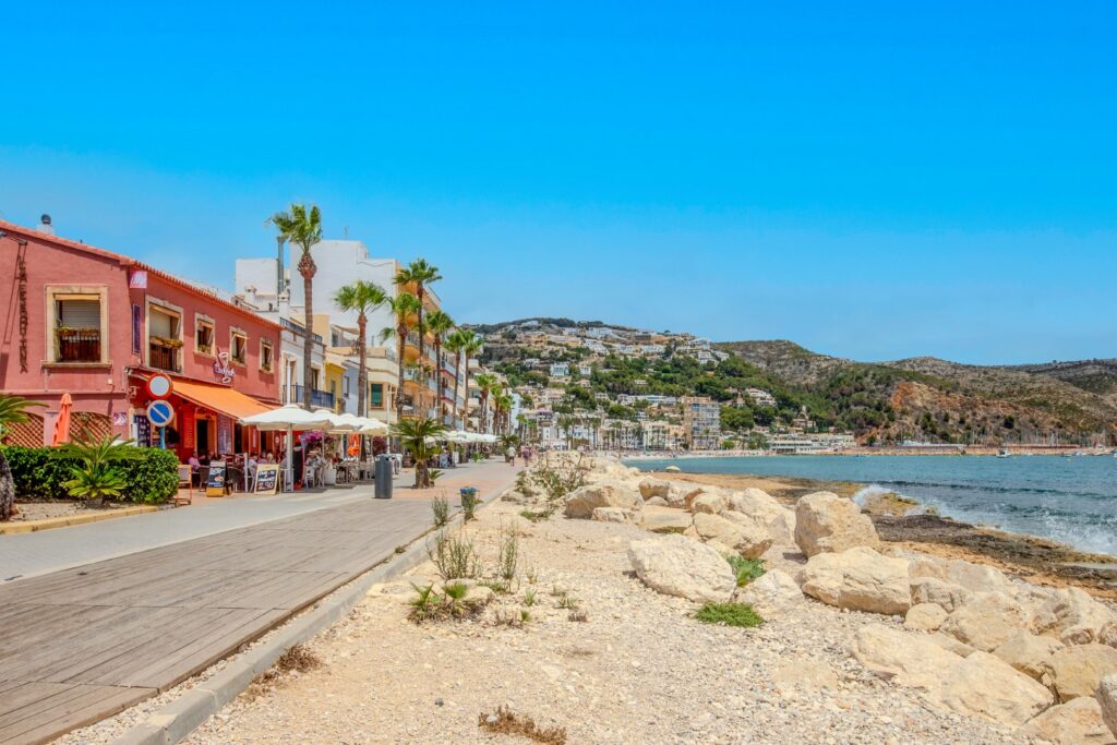
It is also the easiest place to experience the more conventional side of Xàbia.
Here, the coastline is flatter and more urban.
Restaurants and cafés replace cliff paths.
The beach becomes the focus.
This contrast is useful because it prevents the day from becoming one continuous sequence of wild viewpoints.
But if your primary objective is the scenic route, you do not need to spend a long time here.
Think of Arenal as a reset point.
Have coffee.
Walk briefly.
Then continue south.
Cala Blanca and Caletes
Cala Blanca begins to reintroduce the rocky character that becomes much stronger later.
The official coastal guide describes a sequence of small rocky coves and shallow water around this area, with Posidonia meadows appearing offshore.
This can be a pleasant stop, especially if you want a short walk close to the water rather than another elevated viewpoint.
But again, it is not essential if time is limited.
For someone with a full day, Cala Blanca helps bridge the visual transition between Arenal and Portitxol.
For someone trying to keep the route efficient, you can continue directly toward the southern viewpoints.
Creu del Portitxol: Where the Route Starts to Feel Different
Creu del Portitxol is one of the most useful points on the entire route because it marks the transition from Jávea’s broad bay into the more rugged southern coastline.
The setting immediately feels more natural.
Pine trees become more prominent.
The roads narrow.
The sea appears through gaps in the terrain rather than sitting continuously beside you.
And the island of Portitxol begins to dominate the view.
This is where the day stops feeling like a coastal sightseeing drive and starts feeling more like exploration.
More Than a Viewpoint
Creu del Portitxol is not only somewhere to stop and take a photograph.
It also acts as a starting point for walking routes.
One option leads toward Cala Barraca/Portitxol, while another heads toward Cap Prim. The official Xàbia walking information describes the Cap Prim route as a low-difficulty trail of about 2.1 kilometres and roughly one hour, while tourism material also promotes walking from the Portitxol viewpoint toward the nearby coastline.
That makes this one of the best places to decide what kind of day you actually want.
If you are enjoying the driving route, continue.
If the weather is excellent and you suddenly feel like walking, this is where it becomes tempting to leave the car for longer.
The View Toward Portitxol
The offshore island gives the landscape a much stronger focal point than the broad bay views earlier in the day.
Instead of looking over a large open coastline, you are now looking into a smaller, more complex scene.
Headlands overlap.
Pine-covered slopes descend toward the water.
The island breaks the horizon.
The coastline begins to feel layered.
This is exactly the kind of visual change that prevents the viewpoint route becoming repetitive.
Should You Walk Down to Cala Portitxol?
Only if you want the cove to become a major part of the day.
Walking or driving toward Cala Barraca/Portitxol adds another experience, but it also consumes time.
In summer, access and parking around popular Xàbia coves can be regulated, so this is not something I would automatically build into the route without checking current conditions.
If your goal is primarily the viewpoints, enjoy Creu del Portitxol and continue.
If your goal is a mixed day involving swimming or lunch near the water, Portitxol can become much more important.
Why This Is a Good Place to Slow Down
By this point, you will already have seen several different versions of Xàbia.
The broad north.
The windmills.
The bay.
The urban coast.
Now the terrain becomes more dramatic.
This is where I would stop thinking about the official fifteen-viewpoint sequence altogether.
From here south, quality matters much more than quantity.
La Falzia, Cap Negre and Cap de la Nau are close enough geographically that rushing between them would be easy.
But that would miss the point.
The next part of the route contains some of the strongest coastal views of the entire day.
It deserves more time.
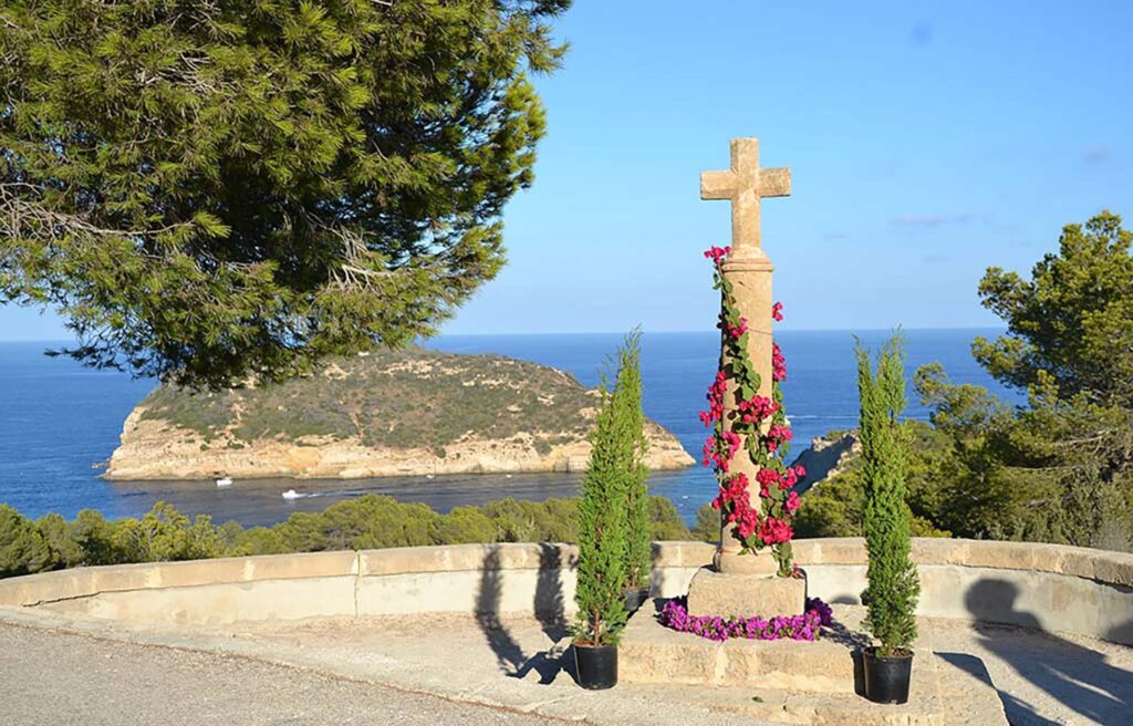
Portitxol and the Central Coastal Viewpoints
Once you leave Creu del Portitxol behind, the route begins to feel more concentrated.
The distances between major viewpoints are relatively short, but the coastline becomes much more dramatic. Cliffs replace broad bay views. Residential roads suddenly open onto deep blue water. The island of Portitxol appears from different angles, and the landscape starts to feel less like a conventional seaside town and more like a sequence of rocky headlands.
This is the part of the route where it becomes tempting to stop everywhere.
That is understandable.
But it is also where choosing well matters most.
If you spend ten minutes at every possible viewpoint, the day begins to feel fragmented. A better approach is to identify two or three places where you genuinely slow down.
La Falzia: One of the Best Views Over Portitxol
La Falzia is one of the strongest viewpoints in the entire route.
The attraction is not only the height.
It is the composition.
From here, the coastline folds around the water in several layers. Pine-covered slopes drop toward the sea. The island of Portitxol sits offshore. Rocky headlands frame the view, and the Mediterranean fills the background.
The scene feels much more intimate than Cap de Sant Antoni.
There, the bay was enormous.
Here, the coastline feels enclosed and sculpted.
That difference makes La Falzia one of the viewpoints most likely to remain in your memory after the day is over.
Why La Falzia Works So Well
The viewpoint has several things working in its favour at once.
First, the elevation gives you a clear sense of the shape of the coast.
Second, the island provides a natural focal point.
Third, the vegetation softens the rocky landscape and adds depth to the scene.
And finally, the view is broad enough to feel impressive without becoming visually empty.
It is an excellent place for photography, but it is also one of those stops where standing still for a few minutes works better than constantly searching for a better angle.
How Long Should You Stay?
Around twenty to thirty minutes is enough for most visitors.
Longer if the light is especially good or if the viewpoint is quiet.
This is also one of the stops where arriving outside peak hours makes a noticeable difference. A scenic viewpoint becomes much less peaceful when several cars arrive at once and everyone is trying to photograph the same section of railing.
If the route has been going well, this is one of the places where I would deliberately slow down.
Southern Jávea: Cap Negre, Cap de la Nau and Ambolo
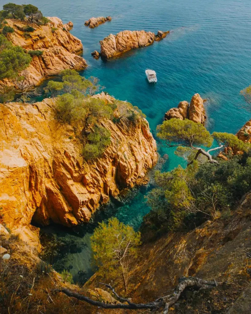
South of Portitxol, the coastline becomes even more rugged.
This section contains some of the most dramatic cliff scenery in Xàbia and arguably the strongest sequence of viewpoints in the official network.
The three main stops — Cap Negre, Cap de la Nau and Ambolo — are close enough to combine easily, but each one feels different enough to justify its place.
Cap Negre: A More Rugged, Exposed View
Cap Negre feels less polished than some of the better-known stops.
That is part of its appeal.
The viewpoint looks across steep coastal terrain where the land seems to fall directly into the Mediterranean.
There is less visual softness here than at La Falzia.
The coastline feels harsher.
More exposed.
More geological.
This is a good place to appreciate how abruptly the southern Xàbia coast drops into the sea.
Why Cap Negre Feels Different
At La Falzia, the island and vegetation create a scenic composition.
At Cap Negre, the cliff itself becomes the main subject.
The feeling is more elemental.
Rock.
Sea.
Height.
Wind.
This simplicity can make the viewpoint particularly impressive on clear days, when visibility extends far along the coast.
It is also one of the stops where people who enjoy geology or rugged landscapes may spend more time than casual visitors.
Is Cap Negre Essential?
For a first scenic route, I would include it.
Not because it is necessarily the most famous stop, but because it changes the rhythm of the day.
Without Cap Negre, the route risks becoming a sequence of attractive Mediterranean panoramas.
With it, you get a stronger sense of the cliffs themselves.
That variety is important.
Cap de la Nau: The Major Headland
Cap de la Nau is one of the most significant geographic points on this section of the Costa Blanca.
It projects strongly into the Mediterranean and marks one of the easternmost parts of the Valencian coastline.
The setting feels more open than the previous viewpoints.
Instead of looking into a bay or around a small island, you look outward.
The sea becomes the dominant element.
This gives Cap de la Nau a different emotional character.
It feels less enclosed and more expansive.
The Lighthouse Adds Identity
The lighthouse gives Cap de la Nau a stronger sense of place than a simple cliff viewpoint.
Even if you cannot access every part of the headland freely, the structure helps define the landscape and reminds you that this is a navigational point as well as a scenic one.
The combination of lighthouse, cliffs and open sea makes Cap de la Nau one of the most recognisable stops on the route.
Is This the Best Viewpoint of the Day?
Possibly, depending on what you value.
If you like dramatic open-sea views, Cap de la Nau may be your favourite.
If you prefer more layered landscapes with coves, islands and vegetation, La Falzia may feel more interesting.
That distinction is useful because there is no single objective “best” viewpoint.
The route works precisely because different stops appeal to different preferences.
Best Time to Visit
Morning and late afternoon both work well, but the atmosphere changes.
Morning gives you a cleaner, brighter view and often clearer visibility.
Later in the day, the light can become softer and the cliffs gain more texture.
Wind is another major factor.
Cap de la Nau is exposed, and strong wind can make the viewpoint feel significantly more dramatic.
Food and Coffee Around Cap de la Nau
One practical advantage of this section is that you are not completely isolated.
There are places nearby where you can stop for coffee or food, making Cap de la Nau a natural break point in the route.
That can be useful if you have already visited several viewpoints and want to reset before continuing south.
This is another reason not to force every stop into a strict timetable.
A scenic day works better when you allow for unplanned pauses.
Ambolo: Beautiful, but With an Important Warning
Ambolo is one of the most photogenic areas on the southern Xàbia coast.
The viewpoint looks toward a steep cove surrounded by cliffs and clear Mediterranean water.
From above, the scene is exceptionally attractive.
It is also a place where visitors need to distinguish between seeing the cove and accessing the beach.
These are not the same thing.
The Viewpoint Is the Main Experience
For the purposes of this route, Ambolo should be treated primarily as a scenic viewpoint.
The elevated view gives you the full shape of the cove and surrounding cliffs.
That perspective is arguably better than being at sea level anyway.
The coastline here feels narrower and more enclosed than at Cap de la Nau.
The result is a striking visual contrast immediately after the broad open-sea views of the headland.
Do Not Assume the Beach Is Accessible
Cala Ambolo has been subject to access restrictions because of rockfall and safety concerns.
That means you should never plan the day around going down to the beach without checking current official conditions.
This is important because older blogs, maps and photographs can create the impression that the cove is simply another beach stop.
It is not necessarily one.
For this route, the safest and most realistic expectation is:
come for the view.
If access conditions change in the future, treat that as a separate bonus rather than part of the basic itinerary.
Why Ambolo Still Deserves a Stop
Even without beach access, the viewpoint is worth including.
The shape of the cove is distinctive.
The cliffs are dramatic.
The water colour can be exceptional in good light.
And because the viewpoint is elevated, you can appreciate the geography much better than from the beach itself.
How Long Should You Stay?
Around fifteen to twenty minutes is enough for most people.
Ambolo is visually strong, but the viewpoint itself does not require a long visit unless you are photographing the landscape carefully.
At this stage of the day, fatigue can also begin to matter.
You may already have stopped six or seven times.
That is another reason to keep the visit focused.
Which of These Viewpoints Should You Prioritise?
If you are short on time, I would prioritise:
La Falzia for the best layered coastal view.
Cap de la Nau for the most expansive headland experience.
Then choose Cap Negre if you prefer rugged cliffs or Ambolo if you want a more enclosed cove landscape.
That gives you three or four stops with genuinely different personalities.
Trying to see everything is unnecessary.
The official route is valuable because it gives you options.
Your goal is not to complete it.
Your goal is to build a day where each stop adds something new.
By the time you leave Ambolo, you should feel that you have seen several different versions of Xàbia’s coast rather than the same sea view repeated from different roads.
And there is still one final landscape to add.
Granadella changes the mood again.
It is greener, more enclosed and more connected to the forested interior than the exposed headlands you have just crossed.
That makes it a strong place to finish the route.
Granadella and the End of the Route
Granadella is a strong place to finish because it changes the mood again.
After the exposed headlands of Cap Negre, Cap de la Nau and Ambolo, the landscape becomes greener and more enclosed. The road descends through the forested surroundings of the Parque Forestal de la Granadella, a protected area of roughly 700 hectares that forms one of the main natural spaces in southern Xàbia. (xabia.org)
This makes the final part of the route feel less like another viewpoint and more like entering a different environment.
The cliffs are still there.
The Mediterranean is still the focus.
But the forest begins to matter almost as much as the sea.
That shift gives the day a natural ending.
Granadella Is More Than the Beach
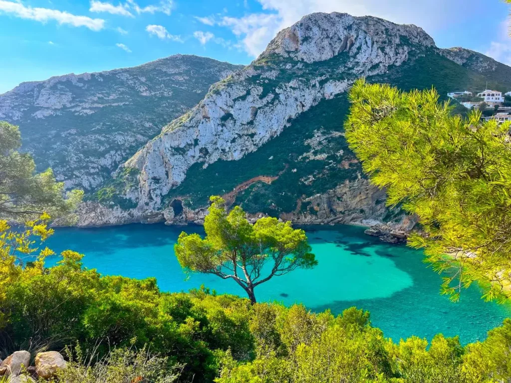
Many visitors know Granadella primarily because of the cove.
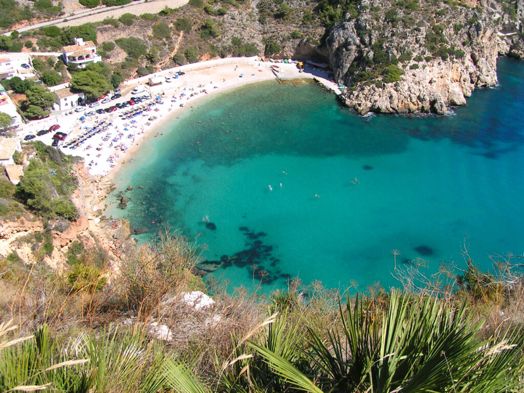
That is understandable. Cala Granadella is one of the best-known beaches in Xàbia and appears constantly in photographs of the Costa Blanca.
But the surrounding landscape deserves just as much attention.
The forest park contains a network of trails and viewpoints, including the official PR-CV 354, a hiking route that passes through the Granadella landscape and provides access to several elevated perspectives. Official Xàbia information describes the full Granadella route as approximately 13.6 kilometres with a duration of around four and a half hours and medium difficulty.
That obviously goes far beyond what most people will want to add after a full viewpoint day.
But it is useful to know the route exists.
It explains why Granadella can easily become a destination in its own right rather than merely the final stop on this itinerary.
Castell de la Granadella Viewpoint
The official viewpoint network includes both Castell de la Granadella and Granadella as the final two stops in the sequence.
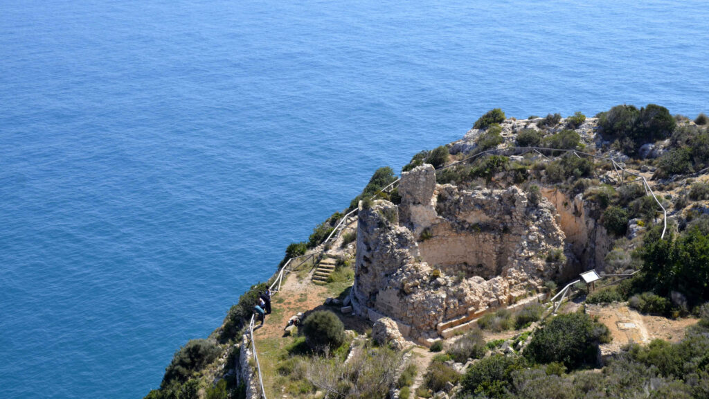
The Castell de la Granadella area provides a more elevated perspective over the southern coastline and the forested landscape.
It is a good final reminder of how much the scenery has changed since the morning.
At Cap de Sant Antoni, you started with a wide panoramic view over Xàbia Bay.
Now, at the southern end, the coastline feels narrower, rougher and more enclosed by vegetation.
That contrast is what gives the whole route coherence.
Cala Granadella
If access is straightforward and you still have time, ending at the cove can work very well.
The water is usually the main attraction, but the shape of the bay is equally important.
The cove is framed by steep slopes and forest, creating a much more enclosed environment than the open headlands farther north.
After spending much of the day above the sea, reaching water level also changes your perspective.
You have spent hours looking down.
Now the cliffs rise around you instead.
That reversal makes Granadella particularly satisfying as a final stop.
Do You Need to Go All the Way Down?
No.
This is especially important in summer.
Granadella can become extremely busy, and access to the cove has been regulated in recent seasons.
If you have already enjoyed the viewpoints and the final descent looks congested, there is no obligation to continue simply because the official route ends there.
The forest and upper viewpoints already provide a strong finish.
The cove is a bonus.
How to Get Around
For a route like this, transport is not a secondary detail.
It determines what kind of day you can realistically have.
The official viewpoint network can be reached in different ways — by car, bicycle or on foot in sections — and Xàbia tourism actively promotes cycling routes connecting several scenic areas.
But for someone travelling from Benidorm and trying to experience the main viewpoints in one day, a car is by far the most practical option.
Why a Car Makes Such a Difference
The viewpoints are spread across a long and irregular coastline.
They are not connected by one simple pedestrian promenade.
Between stops, you often travel through residential streets or inland roads before returning to the sea.
A car allows you to:
- start at Cap de Sant Antoni;
- move efficiently between northern and southern viewpoints;
- skip weaker stops;
- change the plan if parking is difficult;
- carry water, food and beach equipment;
- finish at Granadella without worrying about a return bus.
More importantly, it allows the route to remain flexible.
That flexibility is crucial.
You may discover that La Falzia deserves twice as long as expected.
You may skip Cala Blanca entirely.
You may decide not to descend to Granadella because traffic is heavy.
A car makes those decisions easy.
Does That Mean You Should Stop Everywhere?
No.
Having a car can create the opposite problem.
Because every stop feels accessible, you may start treating the day like a collection exercise.
This usually makes the experience worse.
Use the car to simplify the route, not to increase the number of stops.
For most first-time visitors, six or seven strong viewpoints are more than enough.
Can You Do the Route Without a Car?
Technically, parts of it can be done without one.
Practically, doing the whole route from Benidorm without a car is difficult.
Xàbia’s urban areas are connected by local transport, and some sections of the coast can be reached on foot or by bicycle.
But the viewpoint network extends far beyond the most convenient public transport corridors.
This becomes particularly obvious around:
- Portitxol;
- Cap Negre;
- Cap de la Nau;
- Ambolo;
- Granadella.
Trying to connect all of them by bus would turn a scenic day into a timetable exercise.
Cycling
Cycling is more realistic for experienced riders.
Xàbia officially promotes several cycling itineraries, including a Ruta Miradores de Xàbia, as well as routes around Granadella and Les Planes.
However, distance is only one factor.
The terrain includes hills, narrow roads and significant elevation changes.
Summer heat adds another challenge.
For a fit cyclist familiar with road riding, the viewpoint route can be excellent.
For a casual visitor who simply wants a relaxed sightseeing day, the car remains the better choice.
Taxi or Ride-Hailing
Taxis can work for individual transfers, but they are not ideal for a route involving multiple short stops.
The cost accumulates quickly, and you lose the freedom to stay longer at one viewpoint.
A taxi makes more sense if your objective is simply:
- reach one major viewpoint;
- visit Portitxol;
- go to Granadella;
- return to the town.
For the complete scenic route, hiring or using a car is more efficient.

Planning Your Viewpoint Day
This is one of those experiences where good planning should make the day feel less planned.
The objective is not to create a military timetable.
It is to remove the predictable problems — heat, parking, congestion and wasted driving — so that you can relax once the route begins.
Start Early
An early start is especially valuable in summer.
There are several reasons.
You avoid the hottest part of the day.
Parking is easier.
The viewpoints are quieter.
And you reach the southern section before the main beach traffic builds around Portitxol and Granadella.
For someone travelling from Benidorm, leaving early enough to reach Cap de Sant Antoni in the morning gives the route a much smoother rhythm.
Do Not Start at Arenal
Arenal is convenient, but it is not the best first stop for this particular day.
Starting there places you in the urban middle of Xàbia without giving you the geographic overview that Cap de Sant Antoni provides.
It is better used later as a coffee, lunch or service stop.
Start high.
Understand the bay.
Then move south.
Summer Access Can Change the Route
This is probably the most important practical issue.
In recent summers, Xàbia has regulated vehicle access to Granadella and La Barraca-Portitxol because of limited parking and very high visitor numbers.
For the 2025 season, official information stated that access to both areas was controlled by barriers, with paid parking from mid-June through mid-September and weekend/holiday controls continuing into October. When available spaces filled, vehicle access was closed. Granadella had 130 regulated spaces and Barraca-Portitxol 59.
Those exact dates and prices should not automatically be assumed for 2026, because seasonal access rules can change.
The important lesson is broader:
if you are visiting in high season, check the current Xàbia access information before leaving Benidorm.
A route that works perfectly in May may require a different strategy in August.
Granadella Transport in Summer
The 2025 system also included a tourist transport service from the La Guàrdia parking area to Granadella, while no equivalent public transport service was available to La Barraca-Portitxol.
Again, the exact arrangement may change each season.
But this illustrates why a summer viewpoint day should remain flexible.
You may decide that seeing Portitxol from above is enough.
You may leave Granadella for another day.
That is not a failed itinerary.
It is sensible adaptation.
Parking at the Viewpoints
Most viewpoint stops do not have enormous formal car parks.
In several cases, you are dealing with small roadside or residential parking areas.
That creates two simple rules.
First, never assume that because another car is parked somewhere, parking is legal.
Second, do not block:
- driveways;
- narrow residential roads;
- emergency access;
- turning areas.
This is particularly important around the southern viewpoints, where roads can be narrower and residential.
Summer Heat
The route looks easy because you spend a lot of time in the car.
Do not underestimate the cumulative heat.
You repeatedly get out.
Walk.
Stand in exposed viewpoints.
Return to a hot vehicle.
Repeat.
By afternoon, this can become tiring.
Carry plenty of water even though you are never very far from civilisation.
Sun protection is also essential.
Several of the best viewpoints offer very little shade.
Wind
Wind changes cliff viewpoints more than many visitors expect.
At exposed places such as Cap de Sant Antoni and Cap de la Nau, a strong wind can make the experience much less comfortable.
It can also create genuine safety concerns near exposed edges.
There is no photograph worth leaning over a cliff boundary in strong wind.
Respect barriers and keep a sensible distance from edges even when other visitors do not.
What Should You Bring?
This is not a hiking expedition, so keep equipment simple.
Comfortable shoes are useful because some viewpoints involve short uneven paths.
Bring water, sun protection and a light layer outside summer.
Binoculars can also be surprisingly useful.
You may see:
- seabirds;
- boats;
- distant headlands;
- details on offshore islands.
A small pair adds very little weight and works well on this kind of scenic route.
Should You Bring a Laptop?
No.
This is one of the easiest questions in the guide.
A viewpoint route is a terrible place to carry a laptop unless you have a very specific reason to work later.
You will repeatedly leave the car, walk short distances and potentially spend time near beaches.
Leave the computer in Benidorm.
The whole point of the day is to look farther than the next screen.
How Long Does the Full Route Take?
Do not calculate it by driving time alone.
On a map, the viewpoints can appear deceptively close together.
The actual day includes:
- finding parking;
- walking to viewpoints;
- taking photographs;
- stopping for coffee;
- waiting for traffic;
- lunch;
- changing your mind.
A meaningful full-day route can easily occupy seven to nine hours from leaving Benidorm to returning.
That does not mean you spend nine hours sightseeing intensely.
A good scenic day includes plenty of slow time.
What If You Only Have Half a Day?
Then be selective.
A strong reduced route could include:
Cap de Sant Antoni → Els Molins → La Falzia → Cap de la Nau
That gives you:
- broad bay views;
- historic windmills;
- Portitxol scenery;
- a major exposed headland.
Four stops.
Four different experiences.
Much better than rushing through ten.
The Rule That Makes the Route Work
By this point, the principle should be clear:
never add a viewpoint simply because it is next on the official list.
Add it because it changes the day.
If the next stop looks similar to the previous one and you are already satisfied, skip it.
If you find somewhere unexpectedly beautiful, stay longer.
The official network provides the framework.
You decide the route.
That freedom is what turns the Jávea viewpoints from a sightseeing checklist into one of the most enjoyable scenic days you can build from Benidorm.
Food, Beaches and Useful Stops
A full viewpoint day needs at least one proper pause.
That may sound obvious, but scenic routes are surprisingly good at encouraging bad habits. You keep thinking the next viewpoint is only fifteen minutes away, so you postpone lunch, skip coffee and eventually realise that you have spent five hours getting in and out of the car.
Jávea gives you plenty of places to break that rhythm.
The most convenient areas are the Arenal, the port and, depending on your route, parts of the southern coast around Cap de la Nau. Each offers a different kind of stop.
Arenal as the Practical Midday Break
Arenal is the easiest option if you want maximum choice.
There are cafés, restaurants, toilets, shops and a long seafront where you can sit down properly rather than eating beside the car.
It also sits naturally between the northern viewpoints and the more dramatic southern section.
That makes it a good place to reset.
You can arrive after Cap de Sant Antoni and Els Molins, have coffee or an early lunch, then continue toward Portitxol feeling as though the route has started again.
The downside is that Arenal is one of the busiest parts of Xàbia, especially in summer.
If the entire purpose of your day is escaping crowds, you may prefer a quieter restaurant farther from the beach.
The Port
The port area works better if you want a more traditional coastal atmosphere.
It feels less resort-oriented than Arenal and gives you another perspective on Xàbia before you continue south.
This can be particularly useful if you started at Cap de Sant Antoni, because the port you were looking down at earlier suddenly becomes part of the experience at sea level.
That kind of geographic connection makes the day feel more coherent.
Should You Eat Near Cap de la Nau?
It can make sense, especially if you prefer to keep moving south before taking a longer break.
There are restaurants and cafés in the residential areas around the headland, and stopping here divides the route nicely.
The advantage is that you complete most of the strongest viewpoints before lunch.
The disadvantage is that you have fewer options than in Arenal or the port.
During busy periods, a reservation may be useful if you have a specific place in mind.
What Kind of Food Fits the Day?
Jávea is one of those destinations where a heavy, elaborate lunch can either improve the day or completely destroy your motivation to continue.
If you still have several viewpoints ahead, keep it relatively light.
Rice dishes, fish, seafood and Mediterranean menus all make sense, but you do not need to turn lunch into a two-hour event unless that is deliberately part of the plan.
If the route is almost finished and Granadella is your final stop, a longer meal becomes easier to justify.
Should You Add a Beach Stop?
Yes, if you want the route to feel less like continuous sightseeing.
A swim can break the day very effectively.
But choose one beach or cove rather than repeatedly trying to descend to every famous spot.
The obvious options include Arenal, Cala Blanca, Portitxol and Granadella.
In high season, however, Portitxol and Granadella require more planning because vehicle access and parking may be regulated.
Arenal is far easier if you simply want an uncomplicated swim.
The Best Kind of Stop Is Sometimes No Attraction at All
One of the advantages of a scenic route is that you do not always need another activity.
Sometimes the best break is simply:
find a café;
sit outside;
drink something cold;
stop navigating.
That pause can make the second half of the route much more enjoyable.
Common Mistakes
The Jávea viewpoint route is easy to organise badly because it looks deceptively simple on a map.
The main mistake is assuming that more stops automatically create a better day.
They do not.
Trying to Complete All 15 Viewpoints
The official network is useful because it gives you options.
It should not become a challenge.
Trying to visit every viewpoint on your first day creates a predictable pattern:
drive;
park;
photograph;
leave.
By the tenth stop, even beautiful scenery starts to feel routine.
Choose quality over completion.
Spending Too Much Time in the Car
This sounds contradictory on a driving route, but it is possible.
If you are constantly moving because you are worried about finishing the itinerary, the landscape becomes something you watch through the windscreen.
The route only works when you actually stop.
At the best viewpoints, leave the car behind mentally as well as physically.
Going Straight to the Most Famous Coves
Portitxol and Granadella are beautiful, but descending to them can consume a large part of the day.
In summer, parking and regulated access make the situation even more complicated.
Do not automatically assume that because you can see a cove from above, you also need to go down to it.
The viewpoint may already be the better experience.
Ignoring Seasonal Access Rules
This is one of the easiest mistakes to avoid.
If you are visiting in summer, check official Xàbia information shortly before leaving Benidorm.
Access controls around the popular coves can change from year to year.
An old blog post describing unrestricted parking may no longer be relevant.
Arriving Too Late
A late start creates several problems at once.
Parking becomes harder.
Popular viewpoints become busier.
The heat increases.
And the route begins to feel rushed before it has properly started.
Morning is the simplest solution.
Trusting Navigation Apps Too Much
Navigation apps are useful for moving between viewpoints, but do not assume every suggested roadside space is suitable parking.
Residential roads around southern Xàbia can be narrow.
If a route looks questionable, turn around rather than forcing the car into an awkward position.
Underestimating How Tiring Short Stops Become
None of the individual viewpoints is physically demanding.
The cumulative effect is different.
After several hours, repeated parking, walking, sun exposure and driving can become surprisingly tiring.
This is why lunch and a proper break matter.
Chasing the Perfect Photograph
The coastline is photogenic enough without taking risks.
Do not climb barriers, approach unstable cliff edges or stand in traffic for a better angle.
Several viewpoints involve real drops.
The view does not improve because you moved one metre closer to the edge.
Using the Day as a Checklist
This is really the mistake behind all the others.
The point is not to be able to say:
“We visited twelve viewpoints.”
The point is to remember three or four of them clearly afterwards.
Suggested Half-Day and Full-Day Routes
The official network is large enough that there is no single correct itinerary.
For a visitor coming from Benidorm, I would use one of two approaches.
Half-Day Scenic Route
A half-day needs discipline.
Do not attempt to include the beaches, town centre and every official viewpoint.
Start at Cap de Sant Antoni.
Spend enough time there to understand Xàbia Bay, then continue to Els Molins for the windmills and a different perspective.
From there, drive south and skip most of the smaller bay stops.
Head directly toward La Falzia.
This is where the route gains its strongest coastal character.
Finish at Cap de la Nau.
Four major stops give you a much better half-day than eight rushed ones.
If time remains, add Cap Negre.
Then return toward Benidorm or stop for food before leaving Xàbia.
Full-Day Scenic Route
For a full day, the route can breathe.
Start again at Cap de Sant Antoni and Els Molins.
Move down through the bay and stop in Arenal or the port for coffee.
You may include Cala Blanca if you want a short low-level coastal walk, but do not feel obliged.
Continue to Creu del Portitxol.
Spend proper time at La Falzia.
Then move through Cap Negre and Cap de la Nau.
At this point, stop for lunch or at least a substantial break.
Continue to Ambolo, treating it as a viewpoint rather than assuming beach access.
Finish around Granadella, either at the upper viewpoints or, if access is easy and you still have energy, down at the cove.
This version creates a natural progression:
wide bay → windmills → urban coast → islands → cliffs → headland → enclosed coves → forest.
That sequence is what makes the full day feel like a journey rather than a collection.
What If You Want to Swim?
Then remove at least one or two viewpoints.
Do not simply add a beach to an already full itinerary.
A realistic version might be:
Cap de Sant Antoni → Els Molins → La Falzia → Cap de la Nau → swim at Arenal or Granadella.
That gives you both perspectives of the coast:
from above and from the water.
Is the Jávea Viewpoint Route Worth It for Digital Nomads?
Very much so.
This is one of the strongest experiences in the series for someone who spends most of the week indoors or working from the same urban base.
The day requires very little formal activity.
There are no tickets to manage.
No guided visit.
No fixed schedule beyond whatever access restrictions apply in summer.
You simply move through the landscape.
That lack of structure can be especially valuable for remote workers.
This Is a Good “No Screen” Day
The route gives you almost no reason to open a laptop.
You use your phone for navigation and photographs, but otherwise the day is entirely physical and visual.
You drive.
Walk.
Look.
Stop.
Continue.
That simplicity makes it a surprisingly effective mental reset after several days of remote work.
Can You Work During the Day?
Yes, because Xàbia has cafés and plenty of urban services.
But I would not recommend building the route around work.
If you need a short session, Arenal or the port are the obvious places.
Otherwise, treat the day as time off.
The scenic route is much more valuable as a break than as a background for emails.
Who Will Enjoy It Most?
The route is especially good for:
photographers;
couples;
slow travellers;
people who enjoy driving;
nature lovers;
visitors who like short walks but not long hikes;
anyone who appreciates coastline more than conventional attractions.
It is also particularly suitable for repeat Costa Blanca visitors who have already seen the major towns and want to understand the geography between them.
Who Might Be Disappointed?
Someone who expects continuous entertainment may find the day too passive.
There are long stretches where nothing “happens”.
You simply look at the coast.
People who dislike driving may also struggle with the format.
And anyone visiting in peak summer without checking access conditions may spend more time thinking about parking than scenery.
The route rewards patience and flexibility more than efficiency.
BenidormNomads Verdict
Jávea’s viewpoint network is one of the best examples of a day trip that becomes stronger when you refuse to treat it like a checklist.
Scenery: 9.5/10
This is the main reason to go.
The coastline changes constantly enough to sustain a full day, particularly from Portitxol south.
Variety: 9/10
Bay views, historic windmills, islands, cliffs, headlands, coves and forest all appear within the same route.
Photography: 10/10
One of the strongest photography experiences in the entire series.
The main challenge is deciding when to stop taking photographs.
Accessibility from Benidorm: 8/10
The drive to Xàbia is straightforward, but the route itself strongly favours having a car.
Without one, experiencing the full network becomes difficult.
Value for Money: 10/10
The viewpoints themselves are free.
Your main costs are transport, food and any parking or seasonal access charges.
Walking Experience: 8/10
You can keep the day physically easy or add several short trails.
The flexibility is excellent.
Crowd Management: 7/10
Outside peak periods, the route can feel relaxed.
In summer, the famous coves and some viewpoints become much busier.
Beaches and Swimming: 9/10
Excellent possibilities, although the best-known coves require more planning during high season.
Remote Work Compatibility: 6/10
There are plenty of places to work in Xàbia if necessary, but the viewpoint route itself is not designed around remote work.
That is probably a good thing.
Digital Detox Value: 10/10
One of the strongest categories.
It is difficult to remain mentally trapped in work when you spend the day moving between cliffs, islands and open sea.
Atmosphere: 9/10
The strongest southern viewpoints create a much wilder coastal atmosphere than many visitors expect from the Costa Blanca.
Overall Rating: 9.2/10
The route combines outstanding scenery, flexibility and very low cost.
Its only real weakness is that summer traffic and access restrictions can complicate what should otherwise be a very simple day.

Are the Jávea Viewpoints Worth the Trip from Benidorm?
Yes.
But not because there are fifteen of them.
That number is almost irrelevant.
The reason to make the journey is that Xàbia compresses an unusually varied coastline into a relatively manageable area.
You begin high above a broad Mediterranean bay.
You pass old windmills.
You descend through a more urban coast.
Then the landscape breaks apart.
Portitxol appears offshore.
Cliffs grow steeper.
Cap Negre becomes more exposed.
Cap de la Nau pushes out into open sea.
Ambolo folds back into a narrow cove.
Granadella finishes the route among forested slopes.
That progression is the experience.
If you simply drive to the most famous viewpoint, take a photograph and return to Benidorm, you will see something beautiful.
If you give the route a full day, choose your stops carefully and allow time for the coastline to change around you, you understand why Xàbia feels so different from Benidorm despite belonging to the same Costa Blanca.
For long-stay residents, that makes it particularly worthwhile.
There is no pressure to “do everything”.
You can visit four viewpoints today and return for another section next month.
You can turn Portitxol into a beach day.
Granadella into a hiking day.
Cap de Sant Antoni into a walking day.
The viewpoint network is not just one itinerary.
It is a framework for discovering Xàbia.
And that makes it much more interesting than a simple collection of places to take photographs.