
Vall de Laguar from Benidorm: Villages, Mountain Views and the Barranc de l’Infern
Vall de Laguar feels surprisingly far from the Costa Blanca most visitors imagine.
There are no seafront promenades.
No high-rise skyline.
No obvious resort atmosphere.
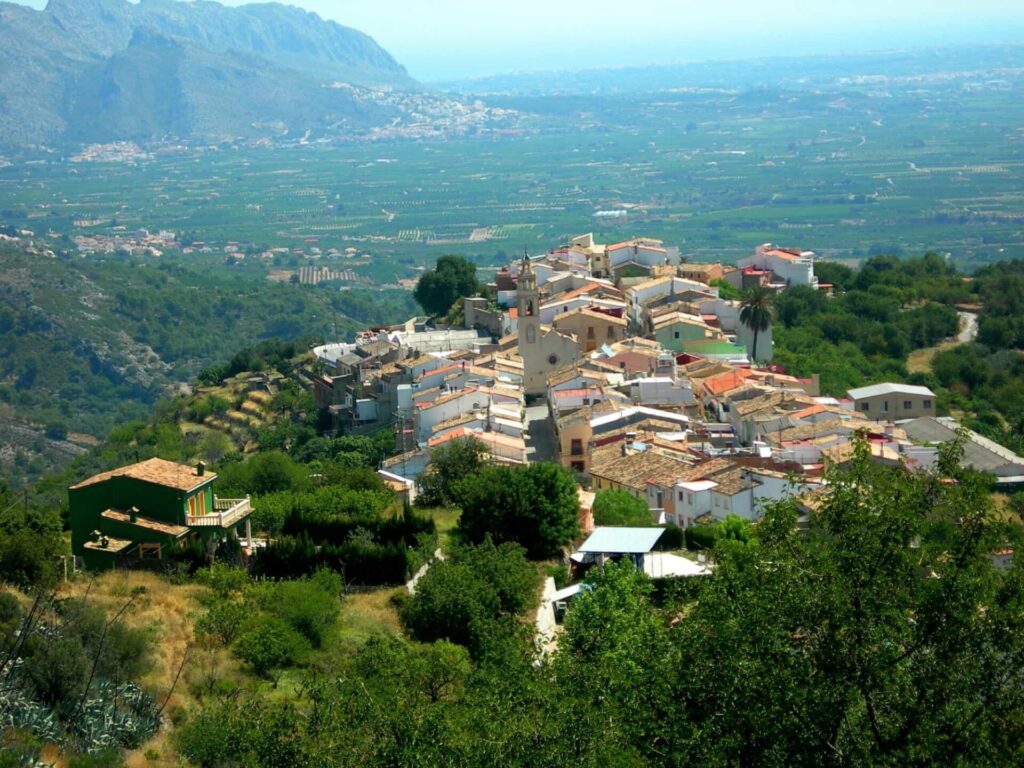
Instead, the landscape is defined by mountain slopes, agricultural terraces, narrow roads, stone walls and small villages that seem to sit naturally within the folds of the valley.
For someone staying in Benidorm, that contrast is exactly what makes the journey worthwhile.
You are not travelling very far in absolute terms, yet the environment changes completely.
The coast disappears.
The road begins to climb.
The terrain becomes more enclosed.
And the rhythm of the day slows down almost automatically.
Most people first hear about Vall de Laguar because of the Barranc de l’Infern, one of the best-known hiking routes in Alicante province. The famous PR-CV 147 circuit is often described as the “Cathedral of Hiking” and is associated with the thousands of old stone steps that climb and descend through the valley.
That route is a major reason to visit.
But it is not the whole story.
Vall de Laguar is also a destination for people who enjoy quiet villages, mountain scenery, rural landscapes and a slower style of exploration.
You can spend the day hiking for six hours.
Or you can drive through the valley, stop in Campell, Fleix and Benimaurell, enjoy the views, have lunch and explore part of the landscape without ever attempting the full PR-CV 147.
Both versions are valid.
This guide is designed to help you decide which one makes more sense.

What Is Vall de Laguar?
Vall de Laguar is a mountain valley in the Marina Alta, inland from the northern Costa Blanca.
The municipality is formed around several small settlements, with Campell, Fleix and Benimaurell forming the main inhabited villages.
The valley sits among rugged limestone mountains and deep ravines, creating a landscape that feels far more dramatic than its relatively modest distance from the Mediterranean might suggest.
The terrain has been shaped both by nature and by centuries of agriculture.
Steep slopes have been transformed into terraces.
Stone walls divide fields.
Old paths cross the mountains.
And the villages occupy positions that reflect the geography rather than any modern urban plan.
This is part of what gives Vall de Laguar such a strong sense of place.
A Valley Defined by Terraces and Ravines
The first thing you notice is how intensely the landscape has been worked.
Agricultural terraces climb the hillsides in layers, supported by dry-stone walls that have survived for generations.
These terraces were not decorative.
They made it possible to farm steep ground that would otherwise have been difficult to use.
The result is a landscape where human effort and mountain geography are almost impossible to separate.
You see this most clearly when looking across the valley.
Natural ravines cut through the terrain, while cultivated terraces follow the contours of the slopes.
Between them, old paths zigzag up and down the mountains.
Those paths are part of the reason the Barranc de l’Infern route feels so distinctive.
A Landscape That Changes With the Seasons
Vall de Laguar does not look exactly the same throughout the year.
Spring can bring more colour to the cultivated areas.
Cherry trees become particularly important in parts of the valley, and their flowering period gives the landscape a softer appearance than the dry summer months.
Later in the year, the terrain becomes harsher and more exposed.
The contrast between green cultivated areas and pale limestone becomes stronger.
For repeat visitors, this seasonal change gives the valley more character than a destination whose appearance remains almost identical year-round.
A Much Quieter Costa Blanca
For anyone based in Benidorm, perhaps the strongest first impression is simply the lack of urban noise.
The villages are small.
Traffic is limited.
There are no major tourist attractions competing for attention.
You are not moving through a destination built around entertainment.
That makes Vall de Laguar particularly appealing to people who want to experience the interior of Alicante rather than another version of the coast.
The change is psychological as much as visual.
You slow down because the place encourages you to.

Why Visit Vall de Laguar from Benidorm?
There are several mountain destinations within reach of Benidorm.
Guadalest offers dramatic scenery and a historic village.
Sierra de Bernia provides a more substantial hiking experience.
Puig Campana offers a serious mountain challenge.
Vall de Laguar occupies a different position.
Its strength comes from the combination of village life, rural landscape and hiking tradition.
You can enjoy the place without committing to a major summit, but if you want a demanding day, the Barranc de l’Infern provides exactly that.
It Shows You a Different Side of Alicante
Benidorm represents one of the most urban and internationally recognisable faces of Alicante province.
Vall de Laguar shows you almost the opposite.
The architecture is smaller.
The roads are quieter.
Agriculture is still visible everywhere.
And the mountains feel like part of everyday life rather than a scenic backdrop.
This contrast makes the excursion especially valuable for long-stay visitors.
You begin to understand that the Costa Blanca is not just a strip of beaches and resort towns.
A relatively short drive inland reveals a completely different landscape and way of life.
The Villages Are Part of the Experience
Unlike a mountain hike where the trailhead is simply a place to park, Vall de Laguar gives you several villages worth stopping in.
Campell, Fleix and Benimaurell each form part of the same valley, but they do not feel interchangeable.
The road linking them gives you repeated views across the terraces and surrounding mountains.
Even a simple drive through the valley feels scenic.
This is important because it means the day does not succeed or fail based on whether you complete the famous hike.
You can still have a worthwhile excursion even if you never attempt the full route.
It Works for Different Energy Levels
This flexibility is one of Vall de Laguar’s strongest advantages.
A serious hiker can spend most of the day completing the PR-CV 147 circuit.
A casual walker can explore a shorter section.
Someone who does not want to hike at all can still enjoy the villages, viewpoints and rural landscape.
That makes the destination easier to recommend to couples or groups where not everyone has the same fitness level.
You do not all need to have exactly the same day.
The Barranc de l’Infern Adds a Sense of Challenge
For hikers, the Barranc de l’Infern gives the valley its strongest identity.
The route is famous not because it reaches one extraordinary summit, but because of the constant rhythm of descent and ascent.
You go down.
Then up.
Then down again.
The old stone steps make the route visually distinctive and physically demanding.
This creates a different type of challenge from a conventional mountain climb.
Instead of one long ascent followed by one descent, the route repeatedly takes energy away from you.
That is exactly why experienced hikers find it so memorable.
A Strong Digital Detox Destination
For remote workers, Vall de Laguar is an excellent place to switch environments completely.
There is very little temptation to multitask.
If you are hiking, the terrain demands attention.
If you are exploring the villages, the pace is too slow to feel compatible with constant screen use.
The valley also offers something that is increasingly difficult to find in more developed coastal areas: silence.
Not absolute silence, of course.
You hear cars occasionally.
Dogs.
Birds.
People in the villages.
But the background noise is very different from Benidorm.
For someone who spends much of the week online, that difference can be surprisingly restorative.

Campell, Fleix and Benimaurell: The Three Villages of the Valley
The three main villages give Vall de Laguar its human character.
They are small enough that you do not need hours to explore each one, but together they create a strong sense of continuity as you move through the valley.
You are not visiting three separate attractions.
You are following one rural landscape through several settlements.
Campell
Campell is often the first of the three main villages visitors encounter when entering the valley.
It provides a gentle introduction to the area.
The village is compact, with traditional streets and views towards the surrounding slopes.
For visitors arriving from Benidorm, this is often the point where the change in atmosphere becomes obvious.
You have left the larger coastal towns behind.
The road narrows.
Buildings become lower.
And the mountains begin to feel much closer.
Campell works well as a first stop if you want to slow down before continuing deeper into the valley.
Fleix
Fleix is particularly important for hikers because it is the usual starting point for the PR-CV 147 route through the Barranc de l’Infern.
That gives the village a slightly different character.
On good-weather mornings, you may see hikers preparing equipment, checking routes or beginning the descent towards the old stone paths.
But Fleix is not simply a trailhead.
Its position within the valley also provides excellent access to the surrounding rural landscape.
If you are not doing the full hike, this is still one of the most useful places to stop because several walking possibilities begin nearby.
The village connects naturally with the paths that once linked agricultural areas and neighbouring settlements.
Benimaurell
Benimaurell sits higher in the valley and often feels like the quietest of the three.
The surrounding scenery becomes more open, and the views across the terraces can be particularly impressive.
It is also closely connected with the Barranc de l’Infern route, which passes through this part of the valley before returning towards Fleix.
For hikers, arriving here can feel like reaching the final stage of a long day.
For non-hikers, it offers a completely different experience.
You can arrive by car, enjoy the same mountain setting and appreciate the landscape without having spent several hours climbing stone steps.
That contrast captures Vall de Laguar perfectly.
The valley rewards effort.
But it does not require it.
The Villages Are Small — and That Is the Point
Do not arrive expecting major monuments or a long list of attractions.
That is not what these villages offer.
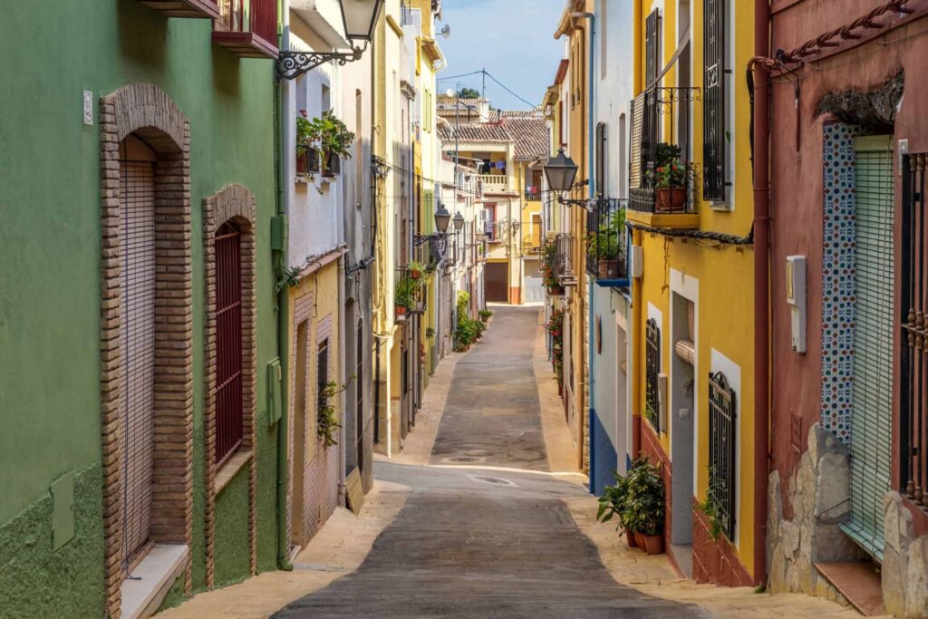
Their appeal comes from the relationship between settlement and landscape.
Stone houses.
Narrow streets.
Mountain views appearing between buildings.
Agricultural terraces beginning almost immediately outside the village.
The experience is subtle.
You are not ticking off sights.
You are understanding how people have lived in this terrain.
Taking Your Time Makes the Difference
A common mistake would be to drive through all three villages in twenty minutes and conclude that there is not much to see.
Technically, you could do that.
But you would miss the point.
Stop.
Walk a little.
Look across the valley.
Have coffee if somewhere is open.
Notice how the landscape changes from one settlement to another.
Vall de Laguar is not a destination that rewards speed.
It rewards attention.
That is also why the Barranc de l’Infern fits the valley so well.
The famous route is demanding, but it follows paths that belong to the landscape rather than feeling imposed on it.
And that is where the next part of the guide begins.
Barranc de l’Infern: The Cathedral of Hiking
The Barranc de l’Infern is the reason many hikers first hear about Vall de Laguar, and it is easy to understand why. The route combines deep ravines, old stone paths, abandoned rural landscapes and a remarkable sequence of ascents and descents that gives the hike a very distinctive rhythm.
Rather than climbing steadily towards one summit, the trail repeatedly drops into the landscape and then forces you to climb back out again, which is exactly what makes it both beautiful and physically demanding.
The official PR-CV 147 circuit starts and finishes in Fleix and covers approximately 14.3 kilometres. The estimated walking time is around six hours and fifteen minutes, although many visitors will take longer once they include breaks, photographs and slower sections.
The accumulated elevation change is substantial, around 1,550 metres, which explains why a route of only fourteen kilometres can feel much harder than the distance suggests. It is not an extreme mountain expedition, but it is certainly not a casual countryside walk either.
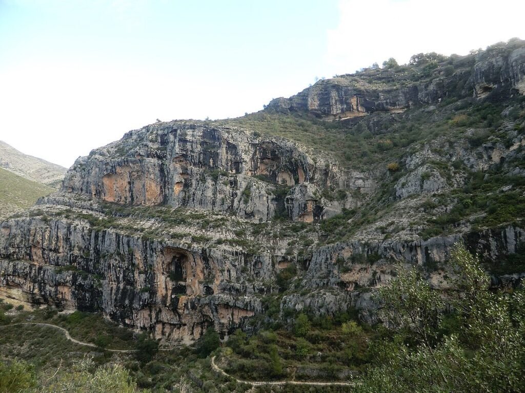
The nickname “Cathedral of Hiking” may sound slightly exaggerated until you begin to see how the old stone paths fit into the landscape. The route crosses a terrain shaped by centuries of movement between villages, agricultural areas and remote rural settlements.
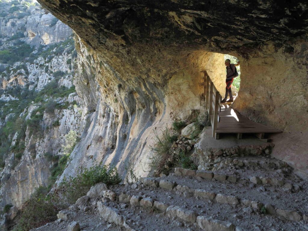
The thousands of steps are not a modern recreational feature built for hikers. They belong to old communication routes that made movement through this difficult landscape possible long before modern roads existed.
That historical connection is part of what makes the hike so memorable. You are not simply following a trail through dramatic scenery; you are walking along infrastructure created by people who needed to move through these mountains as part of everyday life.
The Famous “6,000 Steps”
The expression “6,000 steps” has become strongly associated with the Barranc de l’Infern, although it should not be interpreted as an exact modern count that every hiker will reproduce. It refers to the enormous number of stone steps incorporated into the historic paths crossing the valley, and the visual impression is certainly powerful enough to justify the reputation.
Some sections consist of long stair-like sequences built directly into the slope. Elsewhere, the steps become less obvious as the route follows rough stone tracks and natural terrain. Together, they create a landscape that looks almost engineered into the mountainside.
What makes them demanding is not simply climbing them.
You repeatedly descend many of the same kinds of steps that you later have to climb elsewhere. This constant loss and recovery of elevation gradually accumulates fatigue, especially later in the route when your legs are already tired.
At the beginning, the stone paths can feel almost enjoyable in a historical and visual sense. Several hours later, the experience becomes much more physical.
That progression is one of the defining characteristics of the hike.
Why the Route Is So Different from a Normal Mountain Climb
Many mountain routes have a simple psychological structure. You climb towards a summit, reach the highest point and then descend.
The Barranc de l’Infern does not give you that kind of simplicity.
You can complete a substantial descent and feel as though you have made progress, only to see another steep ascent ahead. Once you reach higher ground again, the route eventually sends you back down into another ravine.
This repeated pattern changes how you need to pace yourself.
If you attack the first climb aggressively because you feel strong, you may regret it several hours later. The route rewards consistency rather than speed.
That is why experienced hikers often describe it as more tiring than its distance initially suggests.
The landscape is constantly making you work.
The PR-CV 147 Route Step by Step
The standard circuit begins in Fleix, where the first part of the route quickly introduces the character of the valley. You leave the village environment and begin moving towards the old paths descending into the ravines below.
At this point, the scenery already starts to open around you. Agricultural terraces cling to the slopes, mountains rise on either side and the route begins to reveal how deeply cut the landscape really is.
The first major descent gives you an immediate understanding of what the hike will involve. Stone steps lead down through terrain that generations of local people once crossed as part of daily life. The path can feel deceptively easy because gravity is doing much of the work, but every metre you lose must eventually be recovered somewhere else.
That is the recurring logic of the entire route.
Descending from Fleix
The initial descent is one of the most visually satisfying parts of the hike because you begin high enough to see how the route disappears into the valley.
The old stone track winds down the slope rather than taking a direct line, creating repeated changes of perspective as you descend.
You pass through a landscape where the boundaries between natural terrain and human construction are difficult to separate. Some terraces still appear clearly maintained, while others have gradually merged back into the hillside. Dry-stone walls remain visible even where agriculture has disappeared.
The effect is particularly strong early in the morning, when lower light can emphasise the shape of the terraces and the depth of the ravines.
Crossing the Barranc de l’Infern
Eventually, the route reaches the lower part of the barranco.
This is where it is useful to clarify what the standard hiking route actually involves.
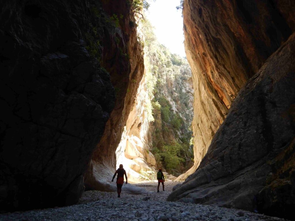
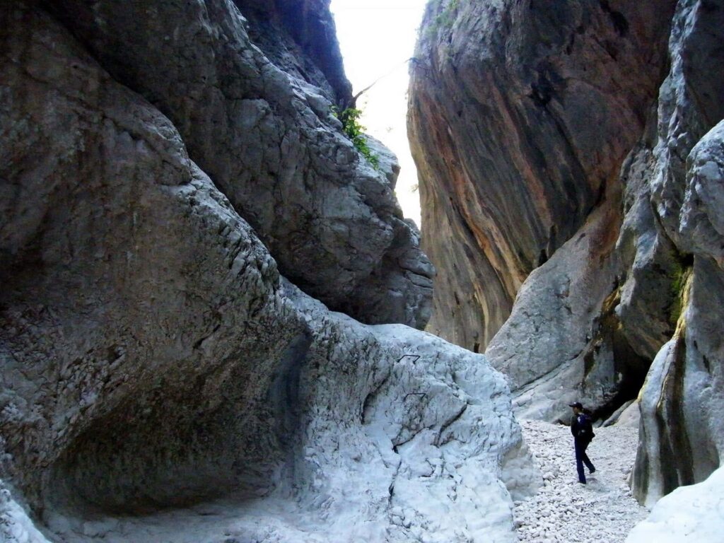
You are not undertaking a technical canyoning descent through the narrowest sections of the Barranc de l’Infern. The PR-CV 147 uses traditional paths to cross and move around the ravine system rather than requiring ropes or technical canyon equipment.
That distinction is important because the name “Barranc de l’Infern” can create the impression that the hiking route follows an extreme gorge from beginning to end.
It does not.
The landscape is dramatic, but the standard route remains a marked hiking trail.
There are, however, technical canyoning sections elsewhere in the Barranc de l’Infern system that should not be confused with the ordinary PR route.
The First Major Climb
After descending into the ravine, the character changes completely.
Now the old stone paths begin climbing again.
This is the point where many hikers start to understand why the route has such a reputation.
The ascent is sustained enough to demand effort, but the surroundings help distract from the fatigue. As you gain height, views begin opening again towards the opposite side of the valley, allowing you to see where you have just come from.
Looking back is almost as interesting as looking ahead.
The route starts to reveal its own structure.
You can trace lines of stone path across slopes that initially seemed inaccessible.
This visual connection between different sections of the route is one of the reasons the hike feels so coherent.
The Jueves and the Old Rural Landscape
Higher sections of the route pass through areas historically associated with the juves, old agricultural settlements and working landscapes scattered across the mountains.
These places add another layer to the experience because they remind you that people once lived and worked much deeper in this terrain than modern visitors might expect.
Today, some of these areas feel extremely isolated.
That makes their historical use all the more impressive.
The paths were not built for recreation.
They connected people with fields, water sources, homes and neighbouring settlements.
Walking through them now gives you a much stronger appreciation of the amount of effort required to maintain life in such difficult geography.
The Second Descent Changes the Mood
By the time the route descends again, most hikers have already accumulated a considerable amount of effort.
This is where the PR-CV 147 begins to feel more demanding psychologically as well as physically.
Another descent can initially seem like relief because your lungs get a break from climbing, but your legs continue working hard on the stone steps.
Repeated downhill movement places different stress on the knees and thighs.
Then, of course, another climb follows.
This alternating pattern is why the route should never be judged only by its kilometre count.
The physical workload is distributed throughout the entire circuit.
The Later Climb Towards Benimaurell
The later stages bring the route back towards higher ground and eventually towards Benimaurell.
For many hikers, this is one of the most satisfying parts of the day because the landscape begins to reconnect with the inhabited valley.
After several hours moving through ravines and old rural paths, seeing the village environment again creates a clear sense of progress.
The views from this side of Vall de Laguar can also be excellent.
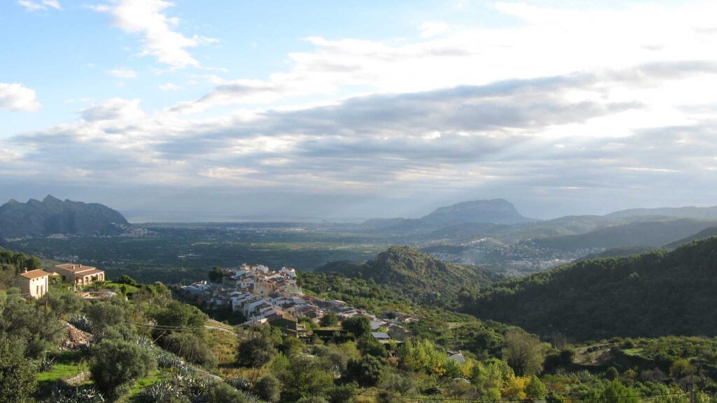
On clear days, the landscape opens towards more distant mountains and, in certain directions, towards the Mediterranean.
That combination of inland terrain with glimpses of the coast is one of the characteristics that makes the Marina Alta so visually distinctive.
Returning from Benimaurell to Fleix
Once you reach Benimaurell, the hardest part of the route is largely behind you.
The return towards Fleix is more comfortable than the major ravine sections, although tired legs can make even easier terrain feel longer than expected.
This final stage is useful psychologically because it allows the route to finish gradually rather than ending immediately after the last demanding climb.
You move back through a more recognisable rural landscape, eventually completing the circuit in Fleix.
By then, the village that felt like a simple starting point several hours earlier can feel surprisingly welcoming.
The route has a genuine sense of completion.
You have not simply walked out and back along the same trail.
You have moved through different sides of the valley and returned with a much clearer understanding of its geography.

How Difficult Is the 6,000 Steps Hike?
The official classification of medium-high difficulty is appropriate, but it does not tell the whole story.
The route is not technically difficult in the way a climbing route or exposed ridge traverse might be. You do not need specialist equipment, and there are no major technical obstacles on the standard PR-CV 147.
The challenge comes from endurance.
Fourteen kilometres combined with repeated steep ascents and descents creates a substantial physical workload. The accumulated elevation is the important number, not simply the highest point reached.
This makes the route especially demanding on the legs.
You Need More Than Basic Walking Fitness
Someone who regularly walks several kilometres on flat urban streets may still find this route hard.
The repeated elevation changes require stronger legs and better endurance than ordinary walking.
A person who regularly hikes, climbs stairs or trains on hills will be much better prepared.
You do not need to be an athlete.
But arriving completely untrained is not a good idea.
The route becomes much more enjoyable when your fitness level allows you to appreciate the scenery instead of spending the second half simply trying to finish.
Descents Are Part of the Difficulty
People often focus on climbing when judging hiking difficulty, but the descents matter just as much here.
Long sections of stone steps can be tiring for the knees, particularly when the surfaces are uneven.
You need to control your movement rather than simply allowing gravity to pull you downhill.
This constant braking creates muscular fatigue that becomes noticeable later in the day.
For hikers with existing knee problems, the route deserves particular consideration.
Walking poles can be useful, especially on the descents, although they are a matter of personal preference.
Heat Can Turn a Difficult Route into a Bad Idea
The official recommendation to avoid summer is sensible.
Large parts of the route are exposed, and the accumulated elevation makes the physical effort substantial even in mild weather.
In hot conditions, the same route becomes dramatically harder.
You need more water.
Your pace slows.
Recovery after each climb becomes more difficult.
And the risk associated with dehydration and heat exhaustion increases.
This is not one of those hikes where starting an hour earlier solves every summer problem.
During periods of extreme heat, choosing another day is the better decision.
Autumn, Winter and Spring Are Much Better
The cooler months suit this route far better.
Autumn can provide excellent walking conditions once summer temperatures begin to fall.
Winter is also very suitable on clear, calm days, although shorter daylight hours make an early start particularly important.
Spring may be the most attractive period overall, especially when cultivated areas are greener and flowering trees add colour to the valley.
The route remains demanding in every season.
But comfortable temperatures allow the difficulty to come from the terrain rather than the weather.
Water and Food Matter More Than People Expect
A six-hour mountain route requires proper preparation.
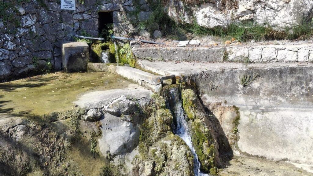
There are fountains associated with the route, including Font Grossa near the beginning and Font Reinós farther along, but relying entirely on natural or public water points is never the best strategy for a demanding hike.
Carry enough water from the start.
The same applies to food.
You do not need elaborate meals, but you should bring enough energy to maintain your pace throughout the day.
A route with repeated climbs can drain you much faster than flat walking.
Navigation
The PR-CV 147 is marked, but hikers should still carry an offline route or GPX track.
Trail markings can be missed.
Junctions may be less obvious than expected.
And fatigue makes navigation mistakes more likely later in the day.
This is especially important because some tracks in the area lead towards alternative routes or more technical sections.
Knowing that you are following the correct PR route removes unnecessary uncertainty.
Who Should Do the Full Route?
The complete circuit is best suited to people who already have some experience with mountain walking and are comfortable spending most of the day on foot.
If you regularly hike routes of similar length and elevation, Vall de Laguar should feel demanding but manageable.
If you have never completed a route with substantial accumulated ascent and descent, the PR-CV 147 may not be the best place to discover your limits.
Fortunately, that does not mean you need to miss Vall de Laguar.
There are shorter ways to experience the same landscape.
You can walk part of the route.
Visit the villages.
Explore viewpoints.
Or follow a shorter itinerary between Fleix, the first ravine sections and Benimaurell.
That flexibility is important because Vall de Laguar should not be treated as an all-or-nothing destination.
The Barranc de l’Infern is the valley’s most famous experience, but it is not the only way to understand the place.

Can You Enjoy Vall de Laguar Without Doing the Full Hike?
Absolutely.
In fact, one of the most important things to understand about Vall de Laguar is that the Barranc de l’Infern is only one way of experiencing the valley. It is the most famous, the most demanding and probably the most memorable option for serious hikers, but it should not define the destination so completely that everyone else assumes there is nothing to do.
The valley has enough character to reward a much slower visit.
You can spend several hours moving between Campell, Fleix and Benimaurell, stop at viewpoints, walk short sections of the old paths and enjoy the agricultural landscape without ever committing to six hours of hiking. For many visitors, especially those travelling from Benidorm simply to discover a different side of Alicante, this may actually be the better introduction.
The key is to change expectations.
If you visit Vall de Laguar looking for major monuments or a dense programme of attractions, the day may feel quiet. If you visit because you want to experience a rural mountain valley, the lack of conventional attractions becomes part of the appeal.
A Slower Way to Explore the Valley
The road through Vall de Laguar naturally connects the main villages, which means you can discover the landscape gradually rather than treating each settlement as an isolated destination.
Campell works well as the first contact with the valley. Fleix introduces you to the hiking landscape and the old paths that descend towards the ravines. Benimaurell takes you higher and gives the whole area a stronger sense of elevation and remoteness.
Between them, the road repeatedly opens towards terraces, ravines and surrounding mountains.
These transitions matter.
Part of the experience comes from noticing how quickly the landscape changes over short distances. A viewpoint may suddenly appear between two bends. A section of cultivated terraces may give way to exposed limestone. A village street may end almost immediately in agricultural land.
That relationship between settlement and landscape is what gives Vall de Laguar its identity.
Walking Part of the Barranc de l’Infern Route
You do not need to complete the full PR-CV 147 to experience its character.
One of the most practical alternatives is to walk only the first section from Fleix towards the Barranc de l’Infern and then return before the route develops into the full circuit.
This allows you to experience some of the historic stone paths, the first major descent and the dramatic scale of the ravine without committing to several hours of repeated climbing.
There is also an officially recognised shorter alternative linking Fleix, the Barranc de l’Infern and Benimaurell, estimated at around three and a half hours. This still requires proper hiking preparation, but it offers a more manageable option for visitors who want something substantial without completing the entire PR-CV 147.
That shorter version is particularly interesting because it connects two of the villages while still giving you a real taste of the ravine landscape.
It should not be confused with an easy walk.
Three and a half hours on this terrain still involves effort.
But it provides a useful middle ground between sightseeing and the full six-hour circuit.
Short Walks Around the Villages
For visitors who prefer something gentler, simply walking around the villages and along the first sections of the surrounding rural paths can be surprisingly rewarding.
These are not dramatic hiking routes with a single famous endpoint.
They are quieter walks through agricultural terraces, old stone walls and the edges of the villages.
That is exactly why they work.
You begin to notice details that disappear when you are focused on completing a long route.
The construction of the terraces.
The way paths follow the contours of the slopes.
Small water features.
Abandoned agricultural structures.
Views opening unexpectedly towards distant mountains.
This kind of exploration suits Vall de Laguar particularly well because the landscape is full of traces of older rural life.
Fontilles as a Different Kind of Visit
Fontilles offers another possibility for visitors who want something beyond the three main villages.
The settlement is historically associated with the former San Francisco de Borja sanatorium colony, established in the early twentieth century. Its buildings occupy a particularly green and secluded part of the valley, creating a very different atmosphere from the exposed terraces around Fleix and Benimaurell.
The area can be reached through routes from Campell and provides another example of how varied Vall de Laguar becomes once you move away from the Barranc de l’Infern.
It is quieter, more wooded and more architectural.
For visitors interested in local history, this can be a valuable complement to the agricultural and mountain landscape.
Cavall Verd and Other Hiking Possibilities
The Barranc de l’Infern receives most of the attention, but it is not the only mountain route associated with Vall de Laguar.
The Sierra del Cavall Verd provides another important hiking landscape, characterised by elevated views and routes through a more open mountain environment.
For a first visit from Benidorm, I would not try to combine a serious Cavall Verd hike with the Barranc de l’Infern. Each deserves its own day.
But knowing these alternatives exist changes the way you think about the valley.
Vall de Laguar is not a one-route destination.
It is a hiking base with several different ways to explore the surrounding mountains.

Shorter Walks, Viewpoints and Rural Landscapes
One of the most enjoyable things about Vall de Laguar is that you do not need a formal viewpoint platform to find good views.
The valley itself creates them.
As the road climbs and turns between the villages, the surrounding terrain opens repeatedly towards terraces, ravines and distant ridges. Benimaurell, in particular, offers broad perspectives across the valley and towards the wider Marina Alta.
On clear days, some elevated points also provide glimpses towards the Mediterranean.
That combination of mountain and distant sea is one of the details that makes this part of Alicante so distinctive.
You are clearly inland.
But the coast never feels completely disconnected.
The Landscape Is the Main Attraction
This is worth emphasising because it changes how you should organise the day.
You do not need to search for ten separate sights.
You need time.
Time to stop.
Time to walk.
Time to look across the terraces.
Time to sit somewhere and let the landscape become familiar.
That may sound less exciting than a list of attractions, but it is exactly what makes Vall de Laguar feel different from more conventional day trips.
The valley does not demand constant attention.
It rewards it.
Dry-Stone Terraces
The agricultural terraces are one of the defining elements of the landscape.
Dry-stone walls have allowed cultivation on steep slopes for generations, creating horizontal layers across terrain that would otherwise be difficult to farm.
These structures are visually attractive, but they are also practical evidence of how people adapted to the geography.
Building and maintaining them required enormous amounts of labour.
Once you notice that, the landscape becomes easier to read.
The walls are not decorative.
They are a record of survival and adaptation.
This is one reason Vall de Laguar feels so culturally rich even when there are relatively few conventional monuments.
The landscape itself functions almost like a historical document.
Food, Cherries and the Agricultural Landscape
Agriculture is still central to the identity of Vall de Laguar, and cherries are probably the crop most strongly associated with the valley.
The wider mountain area forms part of the protected geographical indication Cerezas de la Montaña de Alicante, and cherry trees are a familiar feature of the cultivated slopes.
Their importance becomes particularly visible during flowering and harvest periods.
Spring transforms parts of the valley as the trees come into blossom, creating a much softer landscape than the dry limestone scenery seen later in the year.
When the fruit season arrives, cherries become part of the local economy as well as the visual identity of the valley.
Almond Trees and Seasonal Change
Cherry trees are not the only crop shaping the landscape.
Almond trees also play an important role, and their flowering adds another layer to the seasonal character of the valley.
This means Vall de Laguar can look surprisingly different depending on when you visit.
In late winter and early spring, flowering trees soften the terraces.
Later, green foliage dominates.
Summer dries the landscape.
Autumn brings another change as cultivated areas lose their colour.
This seasonal rhythm is one of the strongest reasons for returning.
A visitor who sees the valley in February may remember something completely different from someone arriving in September.
Food as Part of the Day
For a visitor from Benidorm, lunch should not be treated as an afterthought.
One of the pleasures of exploring inland villages is taking time to stop rather than rushing directly back to the coast.
Restaurants and rural establishments in and around the valley can provide a natural break between walking and sightseeing.
Traditional mountain cooking tends to feel heavier and more substantial than coastal food, which fits the environment perfectly after a morning outdoors.
There is no need to build the entire day around a famous restaurant.
The value comes from the setting.
Sitting down for lunch after walking through terraces and stone paths helps the excursion feel complete.
Cherries as More Than a Souvenir
If you visit during the right season, buying local cherries is one of the simplest ways to connect with the agricultural identity of the valley.
But the fruit is more interesting when you understand the landscape behind it.
Those cherries come from terraces created on difficult mountain terrain.
They depend on a farming tradition adapted to slopes, changing weather and relatively limited cultivable land.
That context gives the product more meaning.
You are not simply buying something local.
You are seeing the system that produces it.
Why the Non-Hiking Version Works So Well
A relaxed visit to Vall de Laguar can easily fill most of a day without ever becoming strenuous.
You can start in Campell, continue towards Fleix, walk part of the old paths, stop at viewpoints and finish in Benimaurell before having lunch.
If you want more walking, add a short section towards the Barranc de l’Infern.
If you prefer history, include Fontilles.
If you simply want scenery, spend more time moving slowly through the villages.
That flexibility is what makes Vall de Laguar so useful as a day trip.
The famous hike gives the destination its reputation.
But the valley itself gives you a reason to come even if you never complete it.

How to Get There from Benidorm
Vall de Laguar is relatively easy to reach by car from Benidorm, but the journey becomes progressively more rural as you move inland. That change is part of the appeal because the transition from resort coast to mountain valley happens quite quickly.
Once you leave the main coastal roads, the route begins to climb through a quieter landscape of smaller towns, agricultural fields and increasingly narrow roads until the villages of Vall de Laguar appear within the folds of the mountains.
For most visitors, driving is the most practical option. The valley itself is spread across several settlements, and the flexibility of having a car makes it much easier to move between Campell, Fleix, Benimaurell and the surrounding viewpoints.
Public transport is far less convenient for a day trip of this type because the real value of the visit lies in being able to stop where the landscape opens up, explore one village at your own pace and continue deeper into the valley without depending on limited connections.
If the PR-CV 147 is your main objective, Fleix is the logical destination because it is the standard starting and finishing point for the circular route. In that case, the best approach is to arrive early enough to park sensibly and begin walking before temperatures rise.
If you are visiting the valley more casually, Campell works well as a first stop before continuing through Fleix towards Benimaurell. That sequence allows you to experience the valley gradually rather than driving directly to the highest village and then working backwards.
Parking and Starting the Day
Parking in the villages is relatively informal compared with large tourist attractions, which means a little common sense goes a long way. These are lived-in mountain settlements, not giant hiking centres with dedicated car parks, so visitors should avoid blocking entrances, narrow streets or agricultural access.
For the Barranc de l’Infern route, arriving early is particularly useful on weekends with good weather. The PR-CV 147 is one of the best-known hikes in Alicante, and popular dates can bring significantly more visitors than the size of Fleix might suggest.
An early start also improves the actual hiking experience. The first descents and climbs feel very different in the cooler morning air, and you gain much more flexibility if the route takes longer than expected. Since the official duration is already more than six hours, there is very little benefit in beginning late and spending the final section worrying about daylight.
Best Time to Visit
Vall de Laguar can be enjoyed throughout much of the year, but the best season depends heavily on what you want to do.
For village exploration and short walks, almost any mild day can work. For the full Barranc de l’Infern circuit, the choice of season matters much more. The official recommendation is clear: the route is suitable during most of the year but should generally be avoided in summer because the combination of heat, exposure and accumulated elevation makes an already demanding hike significantly harder.
Spring is probably the most attractive all-round period because temperatures are usually comfortable and the agricultural landscape feels more alive. The valley’s terraces and flowering trees add colour to a route that later in the year can become much drier and harsher.
This is also an excellent time for visitors who want to combine a shorter walk with time in the villages rather than focus only on the full hiking circuit.
Autumn is equally strong. Once the intense summer heat disappears, the Barranc de l’Infern becomes much more manageable, and the valley often feels calmer than during peak holiday periods. For long-stay visitors based in Benidorm, this may be one of the easiest seasons to choose a clear weekday and explore without rushing.
Winter can also be excellent, particularly for experienced hikers who prefer cooler conditions. The main consideration is daylight. A six-hour route leaves much less margin in December than in April, so an early start becomes even more important.
Clear winter days can provide excellent visibility across the surrounding mountains, but rain, strong wind or very cold conditions should still be taken seriously.
Why Summer Changes Everything
The PR-CV 147 is demanding because of repeated elevation changes, not because of one isolated climb. In summer, every ascent becomes harder, recovery takes longer and the amount of water required increases substantially. The landscape offers limited shade in many sections, so there is no reliable way to hide from the heat once you are committed to the circuit.
This is why the sensible summer option is often to visit the valley without doing the full route. You can still explore Campell, Fleix and Benimaurell, enjoy the views and walk short sections early in the morning. The destination remains worthwhile even when the main hike is not.
That flexibility is one of Vall de Laguar’s strengths.

What to Bring and Common Mistakes
The amount of preparation depends on which version of the valley you choose. A relaxed village day requires little more than comfortable shoes, water and sun protection. The full Barranc de l’Infern circuit deserves proper hiking preparation.
Good footwear is one of the most important considerations. The old stone steps and uneven paths can be tiring even in dry conditions, and sections may become slippery after rain. Trail shoes or hiking footwear with reliable grip are far more suitable than casual trainers.
Water is equally important. Official guidance recommends carrying plenty of water and food for the full PR-CV 147 because of its length and repeated climbs. Even though there are traditional fountains associated with the route, you should not rely entirely on them. Conditions can change, and a demanding mountain day is not the place to discover that a water source is unavailable.
Food should be simple and practical. The route lasts long enough that most hikers will benefit from snacks and something more substantial during a longer break. You do not need to carry an elaborate picnic, but you do need enough energy to maintain a steady pace throughout the day.
Navigation is another area where people sometimes become overconfident. The PR-CV 147 is marked, but carrying an offline map or GPX track is still sensible. Fatigue makes route-finding mistakes more likely, especially later in the day when concentration begins to drop.
The Most Common Planning Mistake
The biggest mistake is treating the route as though fourteen kilometres automatically means a moderate day.
It does not.
The accumulated elevation changes everything.
A hiker who regularly completes fourteen kilometres on flat terrain may find the Barranc de l’Infern far more demanding than expected. The route is long, complex and better suited to people who already have some familiarity with mountain walking. Recent official tourism guidance continues to describe it as one of Alicante’s most memorable circular hikes, but also emphasises that it requires trained legs, mountain experience and enough food and water for the day.
The second major mistake is moving too quickly at the beginning. The first descent can create a false sense of ease, and strong hikers may be tempted to attack the first climb aggressively. That usually provides no real advantage. The route rewards a steady rhythm because the repeated ascents continue for hours.
Another common error is assuming that the descent sections are recovery periods. They are not. The old stone steps place considerable stress on the knees and thighs, and controlling your movement downhill can be almost as tiring as climbing.
Weather Matters More Than the Calendar
Even in a good season, the weather should determine whether the route makes sense on a particular day.
Heavy rain can make the stone paths slippery and may also affect conditions around the ravine. Strong winds can reduce comfort on exposed sections. Extreme heat turns a challenging route into a poor decision.
For long-stay visitors in Benidorm, there is no reason to force the schedule.
Choose a better day.
The valley will still be there.
Suggested Half-Day and Full-Day Plans
Vall de Laguar works particularly well because the itinerary can be scaled to match your energy level.
A visitor who simply wants to see the valley can have an excellent day without attempting the full route. A serious hiker can spend almost the entire day on the PR-CV 147. Between those two extremes, there is plenty of room for shorter walks and village exploration.
Half-Day: Villages and Landscape
For a relaxed half-day, begin in Campell and spend some time walking through the village before continuing towards Fleix.
From Fleix, walk a short section of the Barranc de l’Infern route to experience the old stone paths and the first views into the ravine. There is no need to descend too far if you do not want a substantial climb back.
Return to the village and continue by car towards Benimaurell.
This higher part of the valley provides some of the strongest views and gives you a much clearer sense of the surrounding terrain.
Finish with coffee or lunch before returning to Benidorm.
This version works particularly well for visitors who want mountain scenery without turning the day into a physical challenge.
Full Day: The PR-CV 147
For the complete hiking experience, leave Benidorm early and arrive in Fleix with enough time to begin walking in the cool part of the morning.
Follow the full PR-CV 147 circuit through the Barranc de l’Infern, maintaining a steady pace and allowing proper breaks.
Do not build another major attraction into the schedule.
The route itself is enough.
Once you return to Fleix, change shoes if necessary, sit down somewhere in the valley and have a substantial meal.
That final pause is an important part of the day.
After several hours of stone steps, climbs and descents, there is very little reason to rush directly back into the car.
Full Day Without the Full Hike
There is also a very good middle option.
Start in Campell and explore the valley gradually.
Continue to Fleix and follow a shorter section of the PR-CV 147 or the reduced Fleix–Barranc de l’Infern–Benimaurell alternative if your fitness and preparation suit it. The official shorter option is around three and a half hours, which still provides a genuine hiking experience without committing to the complete circuit.
Afterwards, spend time in Benimaurell and have lunch in the valley.
This itinerary gives you much of what makes Vall de Laguar interesting: villages, stone paths, ravine scenery, agricultural terraces and mountain views.
For many first-time visitors, it may actually be the best balance.
The Version I Would Choose
If you already hike regularly, the full PR-CV 147 is the obvious reason to come.
If you do not, I would not treat the route as something you need to complete in order to say you have really seen Vall de Laguar.
The valley is too interesting for that.
A relaxed combination of Campell, Fleix, a shorter walk and Benimaurell gives you a much better introduction than struggling through a route beyond your experience level.
That is ultimately the most useful planning principle for Vall de Laguar: choose the version of the day that allows you to appreciate the valley rather than simply endure it.
Vall de Laguar for Digital Nomads and the BenidormNomads Verdict
Vall de Laguar works especially well for digital nomads and long-stay residents because it offers something that many coastal destinations cannot: a complete change of environment without requiring a major journey.
From Benidorm, the contrast is immediate. The urban skyline disappears, the road becomes quieter and the landscape begins to revolve around terraces, villages and mountain slopes rather than beaches, promenades and high-rise buildings. That shift is precisely what makes the valley valuable for someone who spends much of the week working online.
You do not need to complete the Barranc de l’Infern to feel that change. Simply moving between Campell, Fleix and Benimaurell already creates a very different rhythm. If you do decide to hike, the effect is even stronger because the route demands enough physical and mental attention that work quickly becomes irrelevant.
A Genuine Break from Remote Work
Some day trips still leave plenty of room for distraction. You sit in cafés, move between urban attractions and continue checking your phone because nothing really pulls you away from your normal routine.
Vall de Laguar is different.
On the PR-CV 147, your attention naturally moves towards the terrain, the next climb and the landscape around you. Even on a relaxed village day, the pace is slow enough that the valley encourages you to stop rather than constantly search for the next activity.
That makes it an excellent digital-detox destination.
You are not escaping technology because the valley imposes rules on you. You simply discover that there is very little reason to keep looking at a screen.
Can You Work During the Day?
Technically, you could find somewhere in the villages to sit with a laptop, but that is not the best use of the destination.
Connectivity may vary, opening hours in small rural establishments can be limited, and the entire point of visiting is to experience a landscape that feels different from your normal working environment.
If you genuinely need to work, do it before leaving Benidorm or after returning.
The valley works much better as a deliberate break.
This is especially true if you are hiking. Carrying a laptop through the Barranc de l’Infern would be pointless extra weight and would add nothing to the day.
The Advantage of Being a Long-Stay Visitor
Someone staying in Benidorm for several weeks or months has an advantage that short-term tourists do not.
You can wait for the right day.
You do not need to attempt the PR-CV 147 in excessive heat simply because it is the only free day on your holiday. You can choose a cool weekday, check the weather and visit when the conditions make sense.
You can also split Vall de Laguar into more than one excursion.
One day can focus on the villages and a short walk.
Another can be reserved for the full Barranc de l’Infern route.
That approach suits the valley much better than trying to compress everything into one ambitious schedule.
Who Will Enjoy Vall de Laguar Most?
Vall de Laguar is particularly rewarding for people who enjoy landscapes with a strong sense of place.
Hikers will obviously find plenty to appreciate, especially on the PR-CV 147, but the valley also works for photographers, slow travellers, rural tourism enthusiasts and visitors who simply want to experience an inland side of Alicante.
It is also a strong option for people who prefer destinations that feel lived-in rather than constructed around tourism.
The villages are small.
The agricultural terraces are functional.
The old paths exist because generations of local people needed them.
That authenticity gives the valley much of its character.
Who Might Find It Less Appealing?
Visitors looking for a long list of attractions may find Vall de Laguar too quiet.
There are no major museums, theme parks or monumental sights demanding your attention. The experience depends on your willingness to appreciate landscape, villages and slow exploration.
The full Barranc de l’Infern also requires a realistic understanding of your fitness level.
Someone who dislikes repeated climbs and descents may find the route exhausting rather than rewarding.
Fortunately, that does not disqualify the valley itself.
The non-hiking version remains worthwhile.
BenidormNomads Verdict
Vall de Laguar is one of the strongest inland experiences near Benidorm because it combines hiking, rural culture and mountain scenery without becoming dependent on a single attraction.
Scenery: 9.5/10
The combination of terraces, ravines, limestone mountains and distant coastal views gives the valley exceptional visual variety.
Hiking Experience: 9.5/10
The PR-CV 147 is one of the most distinctive hiking routes in Alicante, especially because of its historic stone paths and repeated elevation changes.
Rural Atmosphere: 10/10
This is one of the valley’s strongest qualities. Campell, Fleix and Benimaurell feel genuinely integrated into the surrounding agricultural landscape.
Historical Landscape: 9/10
The old paths, dry-stone terraces and rural settlements give the valley a strong sense of continuity between landscape and human activity.
Photography: 9/10
The valley changes dramatically with the seasons, and the combination of villages, terraces and mountains offers excellent photographic opportunities.
Difficulty Balance: 8/10
The full Barranc de l’Infern circuit is demanding, but the destination also offers shorter and more accessible alternatives.
Accessibility from Benidorm: 8/10
The drive is manageable, and having a car makes it easy to explore the three villages and surrounding landscape.
Accessibility Without a Car: 4.5/10
Possible in theory, but much less practical because the valley is dispersed and public transport options are limited.
Value for Money: 9.5/10
The main experiences are free. Your principal costs are transport, food and whatever you choose to spend locally.
Food and Local Character: 8.5/10
The rural setting, local produce and mountain restaurants add a lot to the overall experience.
Digital Detox Value: 10/10
One of the strongest destinations in the series for disconnecting from work and urban routine.
Relaxation: 8.5/10
Very high for a village-based visit. Considerably lower if you choose the full PR-CV 147, which is physically demanding.
Overall Rating: 9.2/10
Vall de Laguar combines scenery, authenticity and hiking depth unusually well. It is strong enough for serious hikers but flexible enough to reward visitors who never attempt the full Barranc de l’Infern circuit.
Is Vall de Laguar Worth the Trip from Benidorm?
Yes.
And perhaps more importantly, it is worth the trip for more than one reason.
The Barranc de l’Infern gives Vall de Laguar its reputation, but the valley would still be interesting without it. Campell, Fleix and Benimaurell create a coherent rural landscape that feels genuinely different from the coast, while the agricultural terraces and old stone paths reveal how people have adapted to difficult mountain terrain for generations.
For hikers, the PR-CV 147 is the obvious centrepiece.
It is physically demanding, visually distinctive and memorable enough to justify dedicating most of the day to it.
For everyone else, the valley still works.
You can drive through the villages, follow part of the old paths, stop at viewpoints, enjoy the terraces and have lunch without ever needing to complete six hours of hiking.
That flexibility is one of Vall de Laguar’s greatest strengths.
It does not force one type of experience on every visitor.
You can make the day as active or as relaxed as you want.
What matters is allowing enough time for the valley to reveal itself.
This is not a destination that rewards rushing.
The villages are small.
The main attractions are not concentrated behind ticket counters.
And some of the best moments may simply involve stopping beside a terrace, looking across a ravine or sitting somewhere in Benimaurell after a long walk.
For someone based in Benidorm, Vall de Laguar is especially valuable because it expands your idea of what the Costa Blanca actually is.
The coast remains relatively close.
But the atmosphere could hardly be more different.
That is exactly why it deserves a place on the list.